Sevran elevation
Sevran (Île-de-France, Seine-Saint-Denis), France elevation is 55 meters and Sevran elevation in feet is 180 ft above sea level [src 1]. Sevran is a populated place (feature code) with elevation that is 119 meters (390 ft) smaller than average city elevation in France.
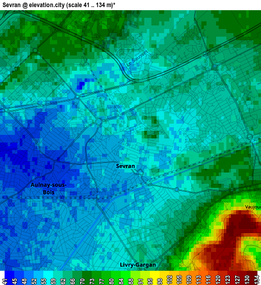
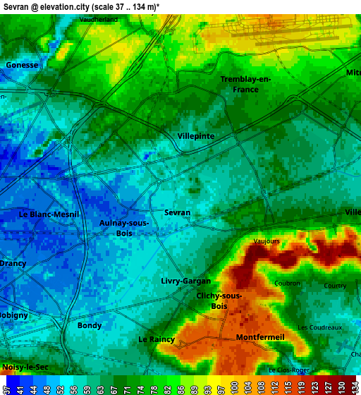
Below is the Elevation map of Sevran, which displays elevation range with different colors. Scale of the first map is from 41 to 134 m (135 to 440 ft) with average elevation of 62.9 meters (=206 ft) [note 1]
These maps also provides idea of topography and contour of this city, they are displayed at different zoom levels. More info about maps, scale and edge coordinates you can find below images.
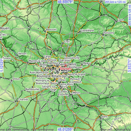
| \ | Map #1 | Map #2 | Topo.Map |
| Scale [m] | 41..134 m | 37..134 m | × |
| Scale [ft] | 135..440 ft | 121..440 ft | × |
| Average | 62.9 m = 206 ft | 69.6 m = 228 ft | × |
| Width | 6.42 km = 4 mi | 12.84 km = 8 mi | 205.4 km = 127.6 mi |
| Height | 6.42 km = 4 mi | 12.84 km = 8 mi | 205.4 km = 127.6 mi |
| ↑Max Latitude | 48.973574° | 49.002412° | 49.85979° |
| Latitude at center | 48.94472° | 48.94472° | 48.94472° |
| ↓Min Latitude | 48.915849° | 48.886961° | 48.01255° |
| ← Min Longitude | 2.483515° | 2.439569° | 1.12121° |
| Longitude center | 2.52746° | 2.52746° | 2.52746° |
| →Max Longitude | 2.571405° | 2.615351° | 3.93371° |
Nearby cities:
Cities around Sevran sort by population:
• Aulnay-sous-Bois elevation 45 m
2.5 km,  253°
253°
• Bondy 51 m
5.5 km,  210°
210°
• Le Blanc-Mesnil 48 m
4.9 km,  262°
262°
• Livry-Gargan 76 m
3 km,  158°
158°
• Villepinte 57 m
2 km,  10°
10°
• Tremblay-en-France 64 m
3 km,  79°
79°
• Clichy-sous-Bois 115 m
4.3 km,  153°
153°
• Les Pavillons-sous-Bois 55 m
4.5 km,  199°
199°
• Le Raincy 111 m
5.1 km,  183°
183°
• Courtry 80 m
6.3 km,  116°
116°
• Vaujours 86 m
3.6 km, 116°
• Coubron 70 m
5.1 km,  127°
127°
Multilingual:
 En español:
Sevran elevación 55 m.
 En France:
Sevran élévation 55 m.


Sources and notes:
- [note 1] Map square and city borders are not equal. Map elevation data is calculated only from area inside that square.
- [src 1] Elevation data from geonames database provided with same terms of usage.
- [src 2] The elevation map of Sevran is generated using elevation data from NASA's 3 arcsec (90m) resolution SRTM data.
- [src 3] Base (background) map © OpenStreetMap contributors tiles are generated by Geofabrik and OpenTopoMap.
Copyright & License:
This Sevran Elevation Map is licensed under CC BY-SA. You may reuse any part from this page, if you give a proper credit by linking to this URL:
 More info on terms of use page.