Thyez elevation
Thyez (Auvergne-Rhône-Alpes, Haute-Savoie), France elevation is 477 meters and Thyez elevation in feet is 1565 ft above sea level [src 1]. Thyez is a populated place (feature code) with elevation that is 303 meters (994 ft) bigger than average city elevation in France.
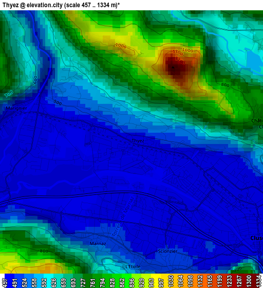
Below is the Elevation map of Thyez, which displays elevation range with different colors. Scale of the first map is from 457 to 1334 m (1499 to 4377 ft) with average elevation of 608.9 meters (=1998 ft) [note 1]
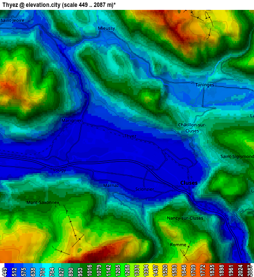
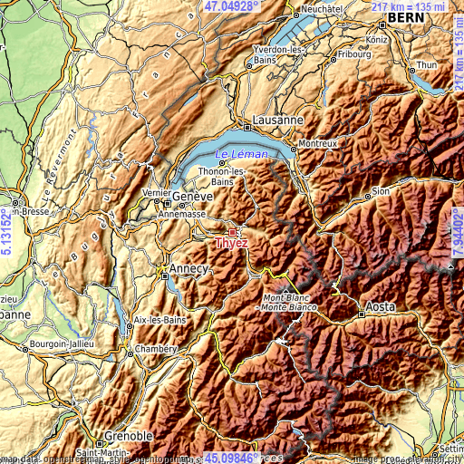
These maps also provides idea of topography and contour of this city, they are displayed at different zoom levels. More info about maps, scale and edge coordinates you can find below images.
| \ | Map #1 | Map #2 | Topo.Map |
| Scale [m] | 457..1334 m | 449..2087 m | × |
| Scale [ft] | 1499..4377 ft | 1473..6847 ft | × |
| Average | 608.9 m = 1998 ft | 885.9 m = 2906 ft | × |
| Width | 6.78 km = 4.2 mi | 13.56 km = 8.4 mi | 216.9 km = 134.8 mi |
| Height | 6.78 km = 4.2 mi | 13.56 km = 8.4 mi | 216.9 km = 134.8 mi |
| ↑Max Latitude | 46.112963° | 46.143419° | 47.04928° |
| Latitude at center | 46.08249° | 46.08249° | 46.08249° |
| ↓Min Latitude | 46.052° | 46.021493° | 45.09846° |
| ← Min Longitude | 6.493825° | 6.449879° | 5.13152° |
| Longitude center | 6.53777° | 6.53777° | 6.53777° |
| →Max Longitude | 6.581715° | 6.625661° | 7.94402° |
Nearby cities:
Cities around Thyez sort by population:
• Cluses elevation 484 m
3.6 km,  127°
127°
• Scionzier 480 m
2.7 km,  155°
155°
• Marignier 473 m
3 km,  286°
286°
• Marnaz 484 m
2.3 km,  202°
202°
• Taninges 670 m
5.1 km,  55°
55°
• Saint-Jeoire 570 m
8.5 km,  316°
316°
• Ayse 491 m
7.1 km,  268°
268°
• Mieussy 637 m
5.8 km,  349°
349°
• Arâches-la-Frasse 962 m
8.5 km,  121°
121°
• Mont-Saxonnex 954 m
6 km,  234°
234°
• Châtillon-sur-Cluses 771 m
3.3 km,  80°
80°
• Vougy 458 m
5.4 km,  252°
252°
Multilingual:
 En español:
Thyez elevación 477 m.
 En France:
Thyez élévation 477 m.


Sources and notes:
- [note 1] Map square and city borders are not equal. Map elevation data is calculated only from area inside that square.
- [src 1] Elevation data from geonames database provided with same terms of usage.
- [src 2] The elevation map of Thyez is generated using elevation data from NASA's 3 arcsec (90m) resolution SRTM data.
- [src 3] Base (background) map © OpenStreetMap contributors tiles are generated by Geofabrik and OpenTopoMap.
Copyright & License:
This Thyez Elevation Map is licensed under CC BY-SA. You may reuse any part from this page, if you give a proper credit by linking to this URL:
 More info on terms of use page.