Tonnerre elevation
Tonnerre (Bourgogne-Franche-Comté, Département de l'Yonne), France elevation is 145 meters and Tonnerre elevation in feet is 476 ft above sea level [src 1]. Tonnerre is a populated place (feature code) with elevation that is 29 meters (95 ft) smaller than average city elevation in France.
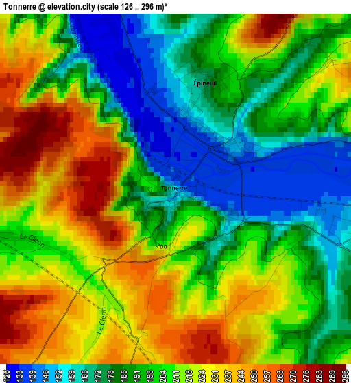
Below is the Elevation map of Tonnerre, which displays elevation range with different colors. Scale of the first map is from 126 to 296 m (413 to 971 ft) with average elevation of 203.8 meters (=669 ft) [note 1]
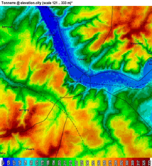
These maps also provides idea of topography and contour of this city, they are displayed at different zoom levels. More info about maps, scale and edge coordinates you can find below images.
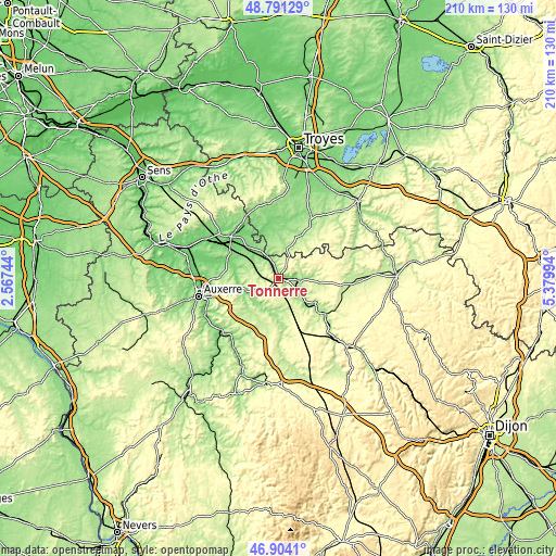
| \ | Map #1 | Map #2 | Topo.Map |
| Scale [m] | 126..296 m | 121..333 m | × |
| Scale [ft] | 413..971 ft | 397..1093 ft | × |
| Average | 203.8 m = 669 ft | 224.9 m = 738 ft | × |
| Width | 6.56 km = 4.1 mi | 13.11 km = 8.1 mi | 209.8 km = 130.4 mi |
| Height | 6.56 km = 4.1 mi | 13.11 km = 8.1 mi | 209.8 km = 130.4 mi |
| ↑Max Latitude | 47.885759° | 47.91522° | 48.79129° |
| Latitude at center | 47.85628° | 47.85628° | 47.85628° |
| ↓Min Latitude | 47.826785° | 47.797273° | 46.9041° |
| ← Min Longitude | 3.929745° | 3.885799° | 2.56744° |
| Longitude center | 3.97369° | 3.97369° | 3.97369° |
| →Max Longitude | 4.017635° | 4.061581° | 5.37994° |
Nearby cities:
Cities around Tonnerre sort by population:
• Saint-Florentin elevation 129 m
24.5 km,  310°
310°
• Chablis 140 m
13.9 km,  250°
250°
• Venoy 219 m
25.8 km,  257°
257°
• Vergigny 99 m
22.9 km,  303°
303°
• Ligny-le-Châtel 125 m
16.8 km,  286°
286°
• Ervy-le-Châtel 156 m
21.1 km,  346°
346°
• Flogny-la-Chapelle 127 m
13.1 km,  322°
322°
• Tanlay 159 m
8.4 km,  98°
98°
• Chaource 147 m
25.6 km,  28°
28°
• Ancy-le-Franc 183 m
16.8 km,  122°
122°
• Neuvy-Sautour 165 m
24.6 km,  327°
327°
• Ravières 191 m
23.3 km,  125°
125°
Multilingual:
 En español:
Tonnerre elevación 145 m.
 En France:
Tonnerre élévation 145 m.
 Auf Deutsch:
Tonnerre höhe über dem Meeresspiegel ist 145 m.

Sources and notes:
- [note 1] Map square and city borders are not equal. Map elevation data is calculated only from area inside that square.
- [src 1] Elevation data from geonames database provided with same terms of usage.
- [src 2] The elevation map of Tonnerre is generated using elevation data from NASA's 3 arcsec (90m) resolution SRTM data.
- [src 3] Base (background) map © OpenStreetMap contributors tiles are generated by Geofabrik and OpenTopoMap.
Copyright & License:
This Tonnerre Elevation Map is licensed under CC BY-SA. You may reuse any part from this page, if you give a proper credit by linking to this URL:
 More info on terms of use page.