Toulaud elevation
Toulaud (Auvergne-Rhône-Alpes, Département de l'Ardèche), France elevation is 219 meters and Toulaud elevation in feet is 719 ft above sea level [src 1]. Toulaud is a populated place (feature code) with elevation that is 45 meters (148 ft) bigger than average city elevation in France.
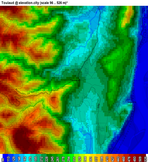
Below is the Elevation map of Toulaud, which displays elevation range with different colors. Scale of the first map is from 96 to 526 m (315 to 1726 ft) with average elevation of 267.8 meters (=879 ft) [note 1]
These maps also provides idea of topography and contour of this city, they are displayed at different zoom levels. More info about maps, scale and edge coordinates you can find below images.
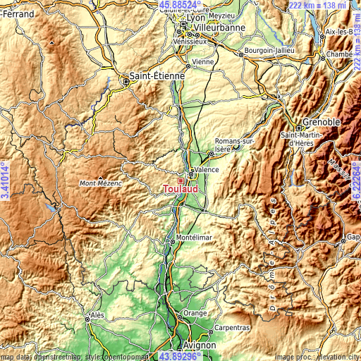
| \ | Map #1 | Topo.Map |
| Scale [m] | 96..526 m | × |
| Scale [ft] | 315..1726 ft | × |
| Average | 267.8 m = 879 ft | × |
| Width | 6.92 km = 4.3 mi | 221.5 km = 137.6 mi |
| Height | 6.92 km = 4.3 mi | 221.5 km = 137.6 mi |
| ↑Max Latitude | 44.928851° | 45.88524° |
| Latitude at center | 44.89773° | 44.89773° |
| ↓Min Latitude | 44.866592° | 43.89296° |
| ← Min Longitude | 4.772445° | 3.41014° |
| Longitude center | 4.81639° | 4.81639° |
| →Max Longitude | 4.860335° | 6.22264° |
Nearby cities:
Cities around Toulaud sort by population:
• Valence elevation 154 m
8 km,  67°
67°
• Bourg-lès-Valence 147 m
8.2 km,  48°
48°
• Guilherand-Granges 112 m
6 km, 49°
• Portes-lès-Valence 120 m
5.2 km,  118°
118°
• Saint-Péray 128 m
6.1 km,  21°
21°
• Étoile-sur-Rhône 180 m
8.8 km,  138°
138°
• Charmes-sur-Rhône 111 m
4.1 km,  158°
158°
• Cornas 126 m
7.8 km, 18°
• Saint-Georges-les-Bains 182 m
4.1 km,  187°
187°
• Soyons 112 m
2.8 km,  109°
109°
• Beauvallon 141 m
8.6 km, 122°
• Beauchastel 110 m
8.1 km, 187°
Multilingual:
 En español:
Toulaud elevación 219 m.
 En France:
Toulaud élévation 219 m.


Sources and notes:
- [note 1] Map square and city borders are not equal. Map elevation data is calculated only from area inside that square.
- [src 1] Elevation data from geonames database provided with same terms of usage.
- [src 2] The elevation map of Toulaud is generated using elevation data from NASA's 3 arcsec (90m) resolution SRTM data.
- [src 3] Base (background) map © OpenStreetMap contributors tiles are generated by Geofabrik and OpenTopoMap.
Copyright & License:
This Toulaud Elevation Map is licensed under CC BY-SA. You may reuse any part from this page, if you give a proper credit by linking to this URL:
 More info on terms of use page.