Tournus elevation
Tournus (Bourgogne-Franche-Comté, Département de Saône-et-Loire), France elevation is 193 meters and Tournus elevation in feet is 633 ft above sea level [src 1]. Tournus is a populated place (feature code) with elevation that is 19 meters (62 ft) bigger than average city elevation in France.
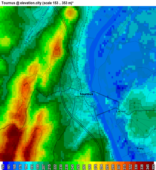
Below is the Elevation map of Tournus, which displays elevation range with different colors. Scale of the first map is from 153 to 353 m (502 to 1158 ft) with average elevation of 213.8 meters (=701 ft) [note 1]
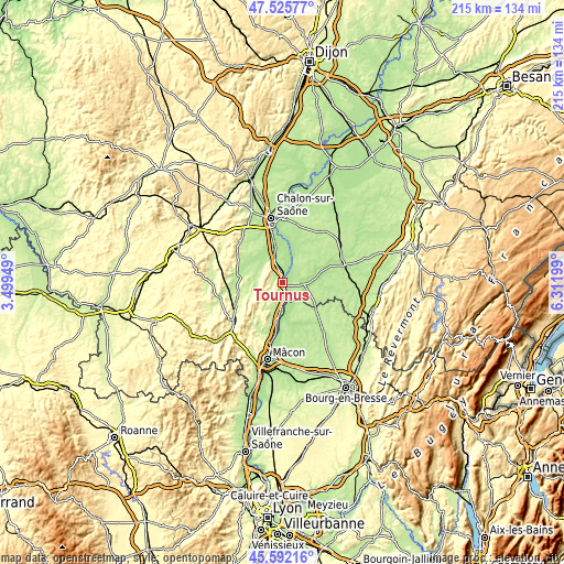
These maps also provides idea of topography and contour of this city, they are displayed at different zoom levels. More info about maps, scale and edge coordinates you can find below images.
| \ | Map #1 | Map #2 | Topo.Map |
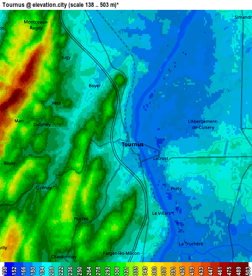
| Scale [m] | 153..353 m | 138..503 m | × |
| Scale [ft] | 502..1158 ft | 453..1650 ft | × |
| Average | 213.8 m = 701 ft | 230.9 m = 758 ft | × |
| Width | 6.72 km = 4.2 mi | 13.44 km = 8.4 mi | 215 km = 133.6 mi |
| Height | 6.72 km = 4.2 mi | 13.44 km = 8.4 mi | 215 km = 133.6 mi |
| ↑Max Latitude | 46.597784° | 46.627971° | 47.52577° |
| Latitude at center | 46.56758° | 46.56758° | 46.56758° |
| ↓Min Latitude | 46.537359° | 46.507122° | 45.59216° |
| ← Min Longitude | 4.861795° | 4.817849° | 3.49949° |
| Longitude center | 4.90574° | 4.90574° | 4.90574° |
| →Max Longitude | 4.949685° | 4.993631° | 6.31199° |
Nearby cities:
Cities around Tournus sort by population:
• Sennecey-le-Grand elevation 210 m
8.7 km,  340°
340°
• Ouroux-sur-Saône 192 m
17.5 km,  11°
11°
• Varennes-le-Grand 190 m
17 km,  350°
350°
• Pont-de-Vaux 188 m
15.2 km,  168°
168°
• Saint-Germain-du-Plain 187 m
15.9 km,  22°
22°
• Cuisery 211 m
7.1 km,  99°
99°
• Romenay 210 m
14.5 km,  120°
120°
• Simandre 206 m
8.8 km,  45°
45°
• Sevrey 192 m
19.6 km, 345°
• Saint-Gengoux-le-National 237 m
19.3 km,  285°
285°
• Montpont-en-Bresse 203 m
19.8 km,  93°
93°
• Saint-Trivier-de-Courtes 213 m
17.8 km,  132°
132°
Multilingual:
 En español:
Tournus elevación 193 m.
 En France:
Tournus élévation 193 m.


Sources and notes:
- [note 1] Map square and city borders are not equal. Map elevation data is calculated only from area inside that square.
- [src 1] Elevation data from geonames database provided with same terms of usage.
- [src 2] The elevation map of Tournus is generated using elevation data from NASA's 3 arcsec (90m) resolution SRTM data.
- [src 3] Base (background) map © OpenStreetMap contributors tiles are generated by Geofabrik and OpenTopoMap.
Copyright & License:
This Tournus Elevation Map is licensed under CC BY-SA. You may reuse any part from this page, if you give a proper credit by linking to this URL:
 More info on terms of use page.