Trie-sur-Baïse elevation
Trie-sur-Baïse (Occitanie, Département des Hautes-Pyrénées), France elevation is 251 meters and Trie-sur-Baïse elevation in feet is 823 ft above sea level [src 1]. Trie-sur-Baïse is a populated place (feature code) with elevation that is 77 meters (253 ft) bigger than average city elevation in France.
Below is the Elevation map of Trie-sur-Baïse, which displays elevation range with different colors. Scale of the first map is from 210 to 388 m (689 to 1273 ft) with average elevation of 284.6 meters (=934 ft) [note 1]
These maps also provides idea of topography and contour of this city, they are displayed at different zoom levels. More info about maps, scale and edge coordinates you can find below images.
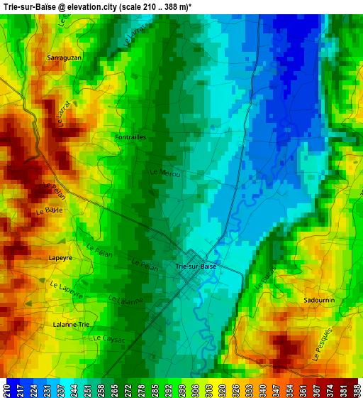
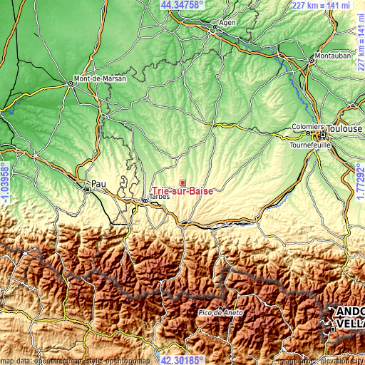
| \ | Map #1 | Topo.Map |
| Scale [m] | 210..388 m | × |
| Scale [ft] | 689..1273 ft | × |
| Average | 284.6 m = 934 ft | × |
| Width | 7.11 km = 4.4 mi | 227.5 km = 141.4 mi |
| Height | 7.11 km = 4.4 mi | 227.5 km = 141.4 mi |
| ↑Max Latitude | 43.365286° | 44.34758° |
| Latitude at center | 43.33333° | 43.33333° |
| ↓Min Latitude | 43.301357° | 42.30185° |
| ← Min Longitude | 0.322725° | -1.03958° |
| Longitude center | 0.36667° | 0.36667° |
| →Max Longitude | 0.410615° | 1.77292° |
Nearby cities:
Cities around Trie-sur-Baïse sort by population:
• Aureilhan elevation 309 m
24.1 km,  245°
245°
• Lannemezan 594 m
23.2 km,  176°
176°
• Séméac 321 m
24.1 km,  241°
241°
• Mirande 152 m
20.4 km,  8°
8°
• Orleix 279 m
20.8 km, 253°
• Boulogne-sur-Gesse 334 m
23.2 km,  99°
99°
• Masseube 211 m
20.2 km,  57°
57°
• Rabastens-de-Bigorre 222 m
18.4 km,  289°
289°
• Miélan 273 m
11.8 km,  336°
336°
• Bazet 271 m
24.7 km,  259°
259°
• Andrest 255 m
24.5 km,  266°
266°
• Tournay 269 m
19.3 km,  210°
210°
Multilingual:
 En español:
Trie-sur-Baïse elevación 251 m.
 En France:
Trie-sur-Baïse élévation 251 m.
 Auf Deutsch:
Trie-sur-Baïse höhe über dem Meeresspiegel ist 251 m.

Sources and notes:
- [note 1] Map square and city borders are not equal. Map elevation data is calculated only from area inside that square.
- [src 1] Elevation data from geonames database provided with same terms of usage.
- [src 2] The elevation map of Trie-sur-Baïse is generated using elevation data from NASA's 3 arcsec (90m) resolution SRTM data.
- [src 3] Base (background) map © OpenStreetMap contributors tiles are generated by Geofabrik and OpenTopoMap.
Copyright & License:
This Trie-sur-Baïse Elevation Map is licensed under CC BY-SA. You may reuse any part from this page, if you give a proper credit by linking to this URL:
 More info on terms of use page.