Villé elevation
Villé (Grand Est, Bas-Rhin), France elevation is 310 meters and Villé elevation in feet is 1017 ft above sea level [src 1]. Villé is a populated place (feature code) with elevation that is 136 meters (446 ft) bigger than average city elevation in France.
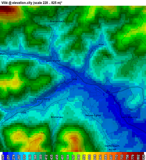
Below is the Elevation map of Villé, which displays elevation range with different colors. Scale of the first map is from 228 to 825 m (748 to 2707 ft) with average elevation of 382.6 meters (=1255 ft) [note 1]
These maps also provides idea of topography and contour of this city, they are displayed at different zoom levels. More info about maps, scale and edge coordinates you can find below images.
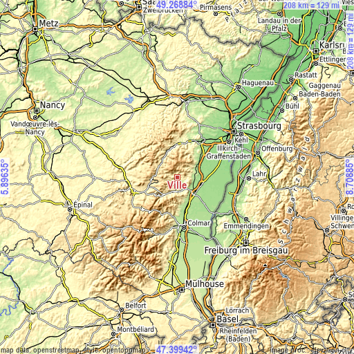
| \ | Map #1 | Topo.Map |
| Scale [m] | 228..825 m | × |
| Scale [ft] | 748..2707 ft | × |
| Average | 382.6 m = 1255 ft | × |
| Width | 6.5 km = 4 mi | 207.9 km = 129.2 mi |
| Height | 6.5 km = 4 mi | 207.8 km = 129.1 mi |
| ↑Max Latitude | 48.371901° | 49.26884° |
| Latitude at center | 48.3427° | 48.3427° |
| ↓Min Latitude | 48.313482° | 47.39942° |
| ← Min Longitude | 7.258655° | 5.89635° |
| Longitude center | 7.3026° | 7.3026° |
| →Max Longitude | 7.346545° | 8.70885° |
Nearby cities:
Cities around Villé sort by population:
• Sélestat elevation 172 m
14.1 km,  129°
129°
• Barr 208 m
13 km,  56°
56°
• Sainte-Marie-aux-Mines 452 m
13.8 km,  219°
219°
• Châtenois 188 m
10.7 km,  137°
137°
• Scherwiller 184 m
10.7 km, 125°
• Sainte-Croix-aux-Mines 339 m
10.5 km,  211°
211°
• Dambach-la-Ville 212 m
9.3 km,  103°
103°
• Epfig 218 m
12.1 km,  81°
81°
• Andlau 231 m
9.7 km, 60°
• Lièpvre 274 m
8 km,  190°
190°
• Kintzheim 209 m
11.9 km,  145°
145°
• Saint-Hippolyte 217 m
13.4 km,  157°
157°
Multilingual:
 En español:
Villé elevación 310 m.
 En France:
Villé élévation 310 m.


Sources and notes:
- [note 1] Map square and city borders are not equal. Map elevation data is calculated only from area inside that square.
- [src 1] Elevation data from geonames database provided with same terms of usage.
- [src 2] The elevation map of Villé is generated using elevation data from NASA's 3 arcsec (90m) resolution SRTM data.
- [src 3] Base (background) map © OpenStreetMap contributors tiles are generated by Geofabrik and OpenTopoMap.
Copyright & License:
This Villé Elevation Map is licensed under CC BY-SA. You may reuse any part from this page, if you give a proper credit by linking to this URL:
 More info on terms of use page.