Barr elevation
Barr (Grand Est, Bas-Rhin), France elevation is 208 meters and Barr elevation in feet is 682 ft above sea level [src 1]. Barr is a populated place (feature code) with elevation that is 34 meters (112 ft) bigger than average city elevation in France.
Below is the Elevation map of Barr, which displays elevation range with different colors. Scale of the first map is from 159 to 835 m (522 to 2740 ft) with average elevation of 277.1 meters (=909 ft) [note 1]
These maps also provides idea of topography and contour of this city, they are displayed at different zoom levels. More info about maps, scale and edge coordinates you can find below images.
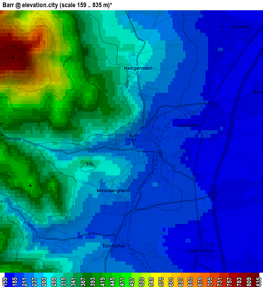
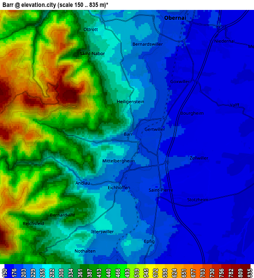
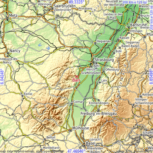
| \ | Map #1 | Map #2 | Topo.Map |
| Scale [m] | 159..835 m | 150..835 m | × |
| Scale [ft] | 522..2740 ft | 492..2740 ft | × |
| Average | 277.1 m = 909 ft | 305.1 m = 1001 ft | × |
| Width | 6.49 km = 4 mi | 12.97 km = 8.1 mi | 207.6 km = 129 mi |
| Height | 6.49 km = 4 mi | 12.97 km = 8.1 mi | 207.6 km = 129 mi |
| ↑Max Latitude | 48.436714° | 48.465861° | 49.3325° |
| Latitude at center | 48.40755° | 48.40755° | 48.40755° |
| ↓Min Latitude | 48.37837° | 48.349172° | 47.46546° |
| ← Min Longitude | 7.404785° | 7.360839° | 6.04248° |
| Longitude center | 7.44873° | 7.44873° | 7.44873° |
| →Max Longitude | 7.492675° | 7.536621° | 8.85498° |
Nearby cities:
Cities around Barr sort by population:
• Obernai elevation 191 m
6.6 km,  21°
21°
• Bischoffsheim 206 m
9.3 km, 18°
• Bœrsch 236 m
7.7 km,  355°
355°
• Epfig 218 m
5.5 km,  167°
167°
• Andlau 231 m
3.3 km,  224°
224°
• Ottrott 280 m
5.7 km,  342°
342°
• Meistratzheim 155 m
8.3 km,  56°
56°
• Valff 159 m
5.5 km,  73°
73°
• Niedernai 161 m
6.9 km,  45°
45°
• Bernardswiller 200 m
4.9 km,  11°
11°
• Kertzfeld 158 m
9.3 km,  109°
109°
• Stotzheim 162 m
4.5 km,  134°
134°
Multilingual:
 En español:
Barr elevación 208 m.
 En France:
Barr élévation 208 m.


Sources and notes:
- [note 1] Map square and city borders are not equal. Map elevation data is calculated only from area inside that square.
- [src 1] Elevation data from geonames database provided with same terms of usage.
- [src 2] The elevation map of Barr is generated using elevation data from NASA's 3 arcsec (90m) resolution SRTM data.
- [src 3] Base (background) map © OpenStreetMap contributors tiles are generated by Geofabrik and OpenTopoMap.
Copyright & License:
This Barr Elevation Map is licensed under CC BY-SA. You may reuse any part from this page, if you give a proper credit by linking to this URL:
 More info on terms of use page.