Villers-le-Lac elevation
Villers-le-Lac (Bourgogne-Franche-Comté, Doubs), France elevation is 835 meters and Villers-le-Lac elevation in feet is 2740 ft above sea level [src 1]. Villers-le-Lac is a populated place (feature code) with elevation that is 661 meters (2169 ft) bigger than average city elevation in France.
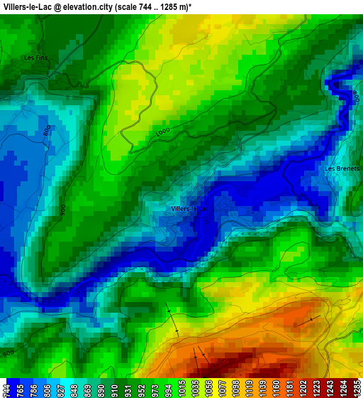
Below is the Elevation map of Villers-le-Lac, which displays elevation range with different colors. Scale of the first map is from 744 to 1285 m (2441 to 4216 ft) with average elevation of 935 meters (=3068 ft) [note 1]
These maps also provides idea of topography and contour of this city, they are displayed at different zoom levels. More info about maps, scale and edge coordinates you can find below images.
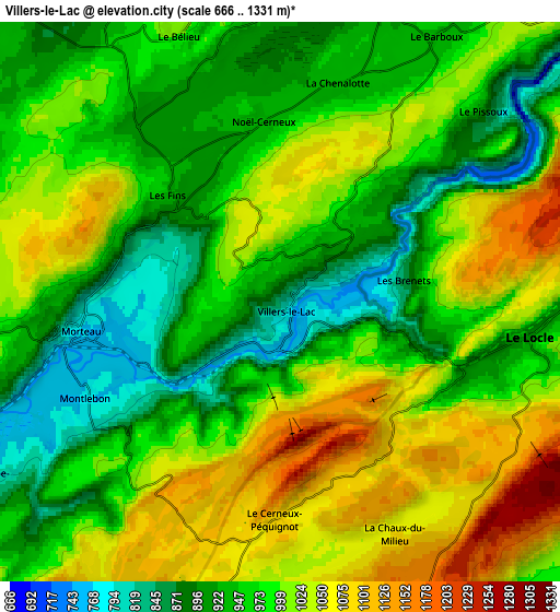
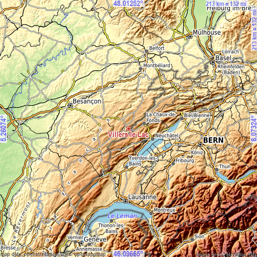
| \ | Map #1 | Map #2 | Topo.Map |
| Scale [m] | 744..1285 m | 666..1331 m | × |
| Scale [ft] | 2441..4216 ft | 2185..4367 ft | × |
| Average | 935 m = 3068 ft | 982.1 m = 3222 ft | × |
| Width | 6.66 km = 4.1 mi | 13.31 km = 8.3 mi | 213 km = 132.4 mi |
| Height | 6.66 km = 4.1 mi | 13.31 km = 8.3 mi | 213 km = 132.4 mi |
| ↑Max Latitude | 47.093117° | 47.123027° | 48.01252° |
| Latitude at center | 47.06319° | 47.06319° | 47.06319° |
| ↓Min Latitude | 47.033246° | 47.003286° | 46.09665° |
| ← Min Longitude | 6.623045° | 6.579099° | 5.26074° |
| Longitude center | 6.66699° | 6.66699° | 6.66699° |
| →Max Longitude | 6.710935° | 6.754881° | 8.07324° |
Nearby cities:
Cities around Villers-le-Lac sort by population:
• Morteau elevation 769 m
4.6 km,  262°
262°
• Valdahon 664 m
25.9 km,  291°
291°
• Maîche 783 m
23.3 km,  26°
26°
• Les Fins 818 m
3.2 km,  299°
299°
• Charquemont 870 m
20.4 km, 34°
• Le Russey 882 m
11.8 km,  23°
23°
• Damprichard 820 m
25.8 km,  38°
38°
• Montlebon 803 m
5.1 km,  236°
236°
• Orchamps-Vennes 757 m
13.1 km, 304°
• Pierrefontaine-les-Varans 692 m
19.5 km,  330°
330°
• Vercel-Villedieu-le-Camp 658 m
24.2 km, 303°
• Gilley 885 m
14.1 km, 262°
Multilingual:
 En español:
Villers-le-Lac elevación 835 m.
 En France:
Villers-le-Lac élévation 835 m.
 Auf Deutsch:
Villers-le-Lac höhe über dem Meeresspiegel ist 835 m.

Sources and notes:
- [note 1] Map square and city borders are not equal. Map elevation data is calculated only from area inside that square.
- [src 1] Elevation data from geonames database provided with same terms of usage.
- [src 2] The elevation map of Villers-le-Lac is generated using elevation data from NASA's 3 arcsec (90m) resolution SRTM data.
- [src 3] Base (background) map © OpenStreetMap contributors tiles are generated by Geofabrik and OpenTopoMap.
Copyright & License:
This Villers-le-Lac Elevation Map is licensed under CC BY-SA. You may reuse any part from this page, if you give a proper credit by linking to this URL:
 More info on terms of use page.