Vouillé elevation
Vouillé (Nouvelle-Aquitaine, Vienne), France elevation is 125 meters and Vouillé elevation in feet is 410 ft above sea level [src 1]. Vouillé is a populated place (feature code) with elevation that is 49 meters (161 ft) smaller than average city elevation in France.
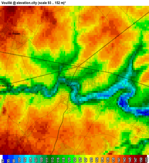
Below is the Elevation map of Vouillé, which displays elevation range with different colors. Scale of the first map is from 93 to 152 m (305 to 499 ft) with average elevation of 129 meters (=423 ft) [note 1]
These maps also provides idea of topography and contour of this city, they are displayed at different zoom levels. More info about maps, scale and edge coordinates you can find below images.
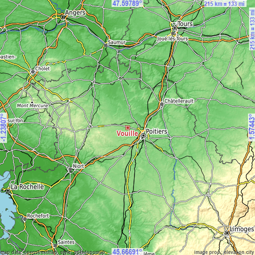
| \ | Map #1 | Topo.Map |
| Scale [m] | 93..152 m | × |
| Scale [ft] | 305..499 ft | × |
| Average | 129 m = 423 ft | × |
| Width | 6.71 km = 4.2 mi | 214.7 km = 133.4 mi |
| Height | 6.71 km = 4.2 mi | 214.7 km = 133.4 mi |
| ↑Max Latitude | 46.671173° | 47.59789° |
| Latitude at center | 46.64101° | 46.64101° |
| ↓Min Latitude | 46.61083° | 45.66691° |
| ← Min Longitude | 0.124235° | -1.23807° |
| Longitude center | 0.16818° | 0.16818° |
| →Max Longitude | 0.212125° | 1.57443° |
Nearby cities:
Cities around Vouillé sort by population:
• Poitiers elevation 85 m
14.9 km,  115°
115°
• Migné 100 m
11.3 km,  97°
97°
• Vouneuil-sous-Biard 122 m
10.9 km,  134°
134°
• Neuville-de-Poitou 113 m
7.6 km,  50°
50°
• Fontaine-le-Comte 143 m
14.2 km,  149°
149°
• Vendeuvre-du-Poitou 103 m
15.1 km, 45°
• Cissé 136 m
4.6 km,  83°
83°
• Biard 120 m
12.7 km, 124°
• Avanton 113 m
10.6 km, 76°
• Latillé 137 m
7.5 km,  251°
251°
• Béruges 130 m
8.7 km,  159°
159°
• Ayron 139 m
7.4 km,  286°
286°
Multilingual:
 En español:
Vouillé elevación 125 m.
 En France:
Vouillé élévation 125 m.


Sources and notes:
- [note 1] Map square and city borders are not equal. Map elevation data is calculated only from area inside that square.
- [src 1] Elevation data from geonames database provided with same terms of usage.
- [src 2] The elevation map of Vouillé is generated using elevation data from NASA's 3 arcsec (90m) resolution SRTM data.
- [src 3] Base (background) map © OpenStreetMap contributors tiles are generated by Geofabrik and OpenTopoMap.
Copyright & License:
This Vouillé Elevation Map is licensed under CC BY-SA. You may reuse any part from this page, if you give a proper credit by linking to this URL:
 More info on terms of use page.