Petäjävesi elevation
Petäjävesi (Central Finland, Jyväskylä), Finland elevation is 138 meters and Petäjävesi elevation in feet is 453 ft above sea level [src 1]. Petäjävesi is a seat of a third-order administrative division (feature code) with elevation that is 61 meters (200 ft) bigger than average city elevation in Finland.
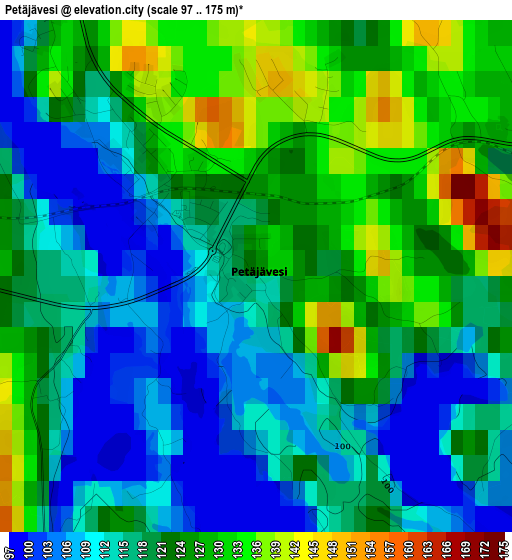
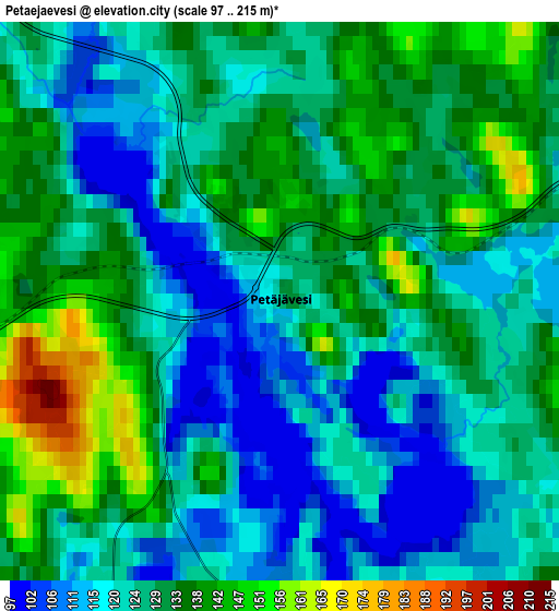
Below is the Elevation map of Petäjävesi, which displays elevation range with different colors. Scale of the first map is from 97 to 175 m (318 to 574 ft) with average elevation of 119.3 meters (=391 ft) [note 1]
These maps also provides idea of topography and contour of this city, they are displayed at different zoom levels. More info about maps, scale and edge coordinates you can find below images.
| \ | Map #1 | Map #2 | Topo.Map |
| Scale [m] | 97..175 m | 97..215 m | × |
| Scale [ft] | 318..574 ft | 318..705 ft | × |
| Average | 119.3 m = 391 ft | 127.2 m = 417 ft | × |
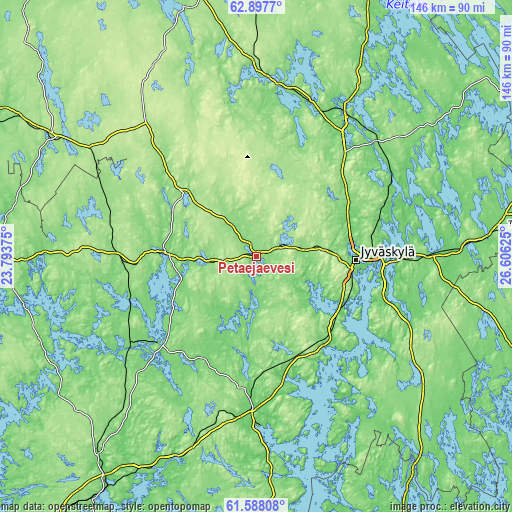
| Width | 4.55 km = 2.8 mi | 9.1 km = 5.7 mi | 145.6 km = 90.5 mi |
| Height | 4.55 km = 2.8 mi | 9.1 km = 5.7 mi | 145.6 km = 90.5 mi |
| ↑Max Latitude | 62.270455° | 62.290895° | 62.8977° |
| Latitude at center | 62.25° | 62.25° | 62.25° |
| ↓Min Latitude | 62.229531° | 62.209049° | 61.58808° |
| ← Min Longitude | 25.156055° | 25.112109° | 23.79375° |
| Longitude center | 25.2° | 25.2° | 25.2° |
| →Max Longitude | 25.243945° | 25.287891° | 26.60625° |
Nearby cities:
Cities around Petäjävesi sort by population:
• Jyväskylä elevation 109 m
27 km,  92°
92°
• Laukaa 89 m
42.9 km,  64°
64°
• Jämsä 83 m
42.9 km,  180°
180°
• Keuruu 118 m
25.9 km,  274°
274°
• Muurame 81 m
27.5 km,  118°
118°
• Jämsänkoski 97 m
36.8 km, 182°
• Mänttä 104 m
38.5 km,  230°
230°
• Vilppula 113 m
44.2 km, 234°
• Korpilahti 109 m
31.7 km,  144°
144°
• Säynätsalo 75 m
32 km,  112°
112°
• Uurainen 198 m
30.6 km,  24°
24°
• Multia 160 m
28.4 km,  310°
310°
Multilingual:
 En español:
Petäjävesi elevación 138 m.
 En France:
Petäjävesi élévation 138 m.
 Auf Deutsch:
Petäjävesi höhe über dem Meeresspiegel ist 138 m.
 На русском:
Петяявеси, Петяйявеси высота над уровнем моря 138 м
Sources and notes:
- [note 1] Map square and city borders are not equal. Map elevation data is calculated only from area inside that square.
- [src 1] Elevation data from geonames database provided with same terms of usage.
- [src 2] The elevation map of Petäjävesi is generated using GMTED2010 database with 7.5 arcsec (225m) resolution.
- [src 3] Base (background) map © OpenStreetMap contributors tiles are generated by Geofabrik and OpenTopoMap.
Copyright & License:
This Petäjävesi Elevation Map is licensed under CC BY-SA. You may reuse any part from this page, if you give a proper credit by linking to this URL:
 More info on terms of use page.