Virrat elevation
Virrat (Pirkanmaa, Ylä-Pirkanmaa), Finland elevation is 127 meters and Virrat elevation in feet is 417 ft above sea level [src 1]. Virrat is a seat of a third-order administrative division (feature code) with elevation that is 50 meters (164 ft) bigger than average city elevation in Finland.
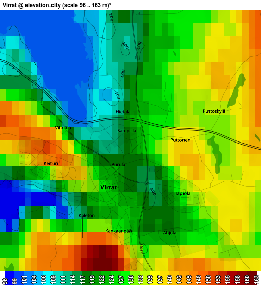
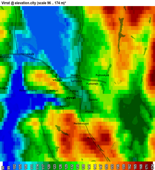
Below is the Elevation map of Virrat, which displays elevation range with different colors. Scale of the first map is from 96 to 163 m (315 to 535 ft) with average elevation of 125.8 meters (=413 ft) [note 1]
These maps also provides idea of topography and contour of this city, they are displayed at different zoom levels. More info about maps, scale and edge coordinates you can find below images.
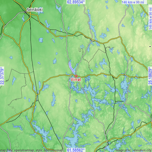
| \ | Map #1 | Map #2 | Topo.Map |
| Scale [m] | 96..163 m | 96..174 m | × |
| Scale [ft] | 315..535 ft | 315..571 ft | × |
| Average | 125.8 m = 413 ft | 128.7 m = 422 ft | × |
| Width | 4.55 km = 2.8 mi | 9.1 km = 5.7 mi | 145.6 km = 90.5 mi |
| Height | 4.55 km = 2.8 mi | 9.1 km = 5.7 mi | 145.6 km = 90.5 mi |
| ↑Max Latitude | 62.268046° | 62.288489° | 62.89534° |
| Latitude at center | 62.24759° | 62.24759° | 62.24759° |
| ↓Min Latitude | 62.22712° | 62.206636° | 61.58562° |
| ← Min Longitude | 23.736095° | 23.692149° | 22.37379° |
| Longitude center | 23.78004° | 23.78004° | 23.78004° |
| →Max Longitude | 23.823985° | 23.867931° | 25.18629° |
Nearby cities:
Cities around Virrat sort by population:
• Keuruu elevation 118 m
47.7 km,  87°
87°
• Alavus 107 m
38.3 km,  347°
347°
• Parkano 114 m
47.3 km,  237°
237°
• Ähtäri 175 m
37 km,  23°
23°
• Mänttä 104 m
50.3 km,  118°
118°
• Vilppula 113 m
45.3 km, 123°
• Ruovesi 134 m
32.5 km,  153°
153°
• Töysä 140 m
42.3 km,  2°
2°
• Kuru 105 m
41.5 km,  184°
184°
• Kihniö 145 m
31.4 km,  260°
260°
• Juupajoki 141 m
58.6 km, 148°
• Multia 160 m
55.1 km,  70°
70°
Multilingual:
 En español:
Virrat elevación 127 m.
 En France:
Virrat élévation 127 m.


Sources and notes:
- [note 1] Map square and city borders are not equal. Map elevation data is calculated only from area inside that square.
- [src 1] Elevation data from geonames database provided with same terms of usage.
- [src 2] The elevation map of Virrat is generated using GMTED2010 database with 7.5 arcsec (225m) resolution.
- [src 3] Base (background) map © OpenStreetMap contributors tiles are generated by Geofabrik and OpenTopoMap.
Copyright & License:
This Virrat Elevation Map is licensed under CC BY-SA. You may reuse any part from this page, if you give a proper credit by linking to this URL:
 More info on terms of use page.