Villa de Vallecas elevation
Villa de Vallecas (Madrid, Provincia de Madrid), Spain elevation is 643 meters and Villa de Vallecas elevation in feet is 2110 ft above sea level [src 1]. Villa de Vallecas is a section of populated place (feature code) with elevation that is 40 meters (131 ft) bigger than average city elevation in Spain.
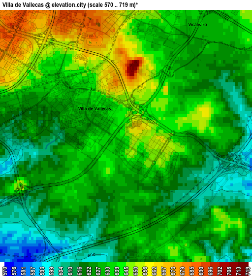
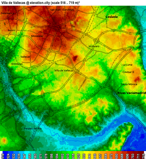
Below is the Elevation map of Villa de Vallecas, which displays elevation range with different colors. Scale of the first map is from 570 to 719 m (1870 to 2359 ft) with average elevation of 631.1 meters (=2071 ft) [note 1]
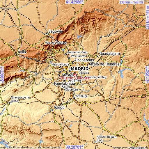
These maps also provides idea of topography and contour of this city, they are displayed at different zoom levels. More info about maps, scale and edge coordinates you can find below images.
| \ | Map #1 | Map #2 | Topo.Map |
| Scale [m] | 570..719 m | 516..719 m | × |
| Scale [ft] | 1870..2359 ft | 1693..2359 ft | × |
| Average | 631.1 m = 2071 ft | 615.5 m = 2019 ft | × |
| Width | 7.45 km = 4.6 mi | 14.89 km = 9.3 mi | 238.3 km = 148.1 mi |
| Height | 7.45 km = 4.6 mi | 14.89 km = 9.3 mi | 238.3 km = 148.1 mi |
| ↑Max Latitude | 40.400424° | 40.433882° | 41.42986° |
| Latitude at center | 40.36695° | 40.36695° | 40.36695° |
| ↓Min Latitude | 40.333459° | 40.299952° | 39.28701° |
| ← Min Longitude | -3.645405° | -3.689351° | -5.00771° |
| Longitude center | -3.60146° | -3.60146° | -3.60146° |
| →Max Longitude | -3.557515° | -3.513569° | -2.19521° |
Nearby cities:
Cities around Villa de Vallecas sort by population:
• Puente de Vallecas elevation 633 m
5.9 km,  299°
299°
• San Blas-Canillejas 663 m
8.1 km,  351°
351°
• Arganzuela 605 m
8.8 km,  294°
294°
• Salamanca 698 m
9.6 km,  316°
316°
• Usera 586 m
8.7 km, 286°
• Villaverde 597 m
8.6 km,  257°
257°
• Retiro 665 m
8.6 km,  306°
306°
• Moratalaz 671 m
6.1 km, 317°
• Coslada 619 m
7.2 km,  28°
28°
• Rivas-Vaciamadrid 570 m
8.9 km,  120°
120°
• Vicálvaro 651 m
3.7 km,  1°
1°
• San Fernando de Henares 588 m
8.6 km,  42°
42°
Multilingual:
 En español:
Villa de Vallecas elevación 643 m.
 En France:
Villa de Vallecas élévation 643 m.
 Auf Deutsch:
Villa de Vallecas höhe über dem Meeresspiegel ist 643 m.

Sources and notes:
- [note 1] Map square and city borders are not equal. Map elevation data is calculated only from area inside that square.
- [src 1] Elevation data from geonames database provided with same terms of usage.
- [src 2] The elevation map of Villa de Vallecas is generated using elevation data from NASA's 3 arcsec (90m) resolution SRTM data.
- [src 3] Base (background) map © OpenStreetMap contributors tiles are generated by Geofabrik and OpenTopoMap.
Copyright & License:
This Villa de Vallecas Elevation Map is licensed under CC BY-SA. You may reuse any part from this page, if you give a proper credit by linking to this URL:
 More info on terms of use page.