Usera elevation
Usera (Madrid, Provincia de Madrid), Spain elevation is 586 meters and Usera elevation in feet is 1923 ft above sea level [src 1]. Usera is a section of populated place (feature code) with elevation that is 17 meters (56 ft) smaller than average city elevation in Spain.
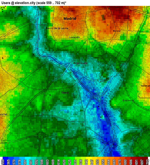
Below is the Elevation map of Usera, which displays elevation range with different colors. Scale of the first map is from 559 to 702 m (1834 to 2303 ft) with average elevation of 615.7 meters (=2020 ft) [note 1]
These maps also provides idea of topography and contour of this city, they are displayed at different zoom levels. More info about maps, scale and edge coordinates you can find below images.
| \ | Map #1 | Map #2 | Topo.Map |
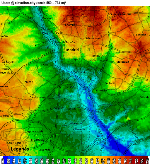
| Scale [m] | 559..702 m | 550..734 m | × |
| Scale [ft] | 1834..2303 ft | 1804..2408 ft | × |
| Average | 615.7 m = 2020 ft | 639.5 m = 2098 ft | × |
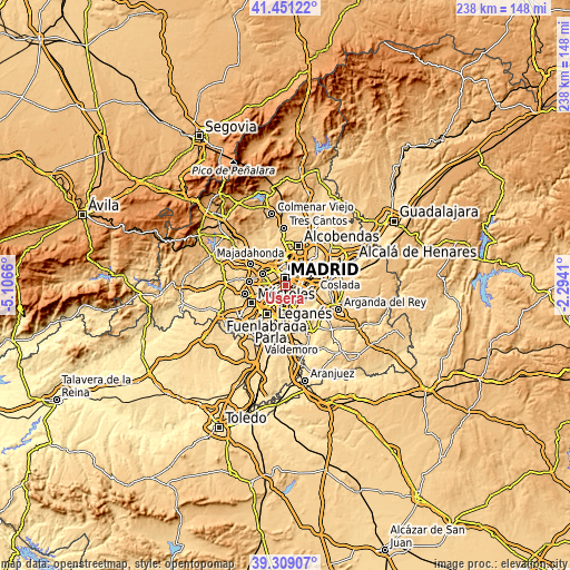
| Width | 7.44 km = 4.6 mi | 14.89 km = 9.3 mi | 238.2 km = 148 mi |
| Height | 7.44 km = 4.6 mi | 14.89 km = 9.3 mi | 238.2 km = 148 mi |
| ↑Max Latitude | 40.422123° | 40.45557° | 41.45122° |
| Latitude at center | 40.38866° | 40.38866° | 40.38866° |
| ↓Min Latitude | 40.35518° | 40.321683° | 39.30907° |
| ← Min Longitude | -3.744295° | -3.788241° | -5.1066° |
| Longitude center | -3.70035° | -3.70035° | -3.70035° |
| →Max Longitude | -3.656405° | -3.612459° | -2.2941° |
Nearby cities:
Cities around Usera sort by population:
• Madrid elevation 665 m
3.1 km,  356°
356°
• Latina 652 m
3.8 km,  270°
270°
• Carabanchel 622 m
2 km,  277°
277°
• Puente de Vallecas 633 m
3.3 km,  80°
80°
• City Center 673 m
3.3 km, 356°
• Arganzuela 605 m
1.3 km,  15°
15°
• Salamanca 698 m
4.9 km, 20°
• Chamberí 693 m
5.1 km, 356°
• Villaverde 597 m
4.3 km,  179°
179°
• Retiro 665 m
3.1 km,  28°
28°
• Moncloa-Aravaca 615 m
5.8 km,  332°
332°
• Moratalaz 671 m
4.8 km,  64°
64°
Multilingual:
 En español:
Usera elevación 586 m.
 En France:
Usera élévation 586 m.


Sources and notes:
- [note 1] Map square and city borders are not equal. Map elevation data is calculated only from area inside that square.
- [src 1] Elevation data from geonames database provided with same terms of usage.
- [src 2] The elevation map of Usera is generated using elevation data from NASA's 3 arcsec (90m) resolution SRTM data.
- [src 3] Base (background) map © OpenStreetMap contributors tiles are generated by Geofabrik and OpenTopoMap.
Copyright & License:
This Usera Elevation Map is licensed under CC BY-SA. You may reuse any part from this page, if you give a proper credit by linking to this URL:
 More info on terms of use page.