Pego elevation
Pego (Valencia, Provincia de Alicante), Spain elevation is 80 meters and Pego elevation in feet is 262 ft above sea level [src 1]. Pego is a seat of a third-order administrative division (feature code) with elevation that is 523 meters (1716 ft) smaller than average city elevation in Spain.
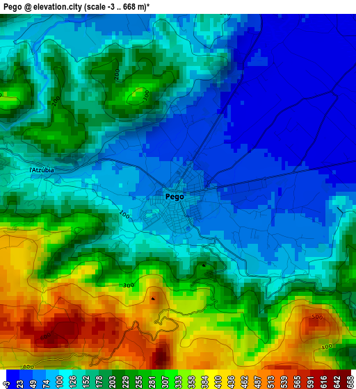
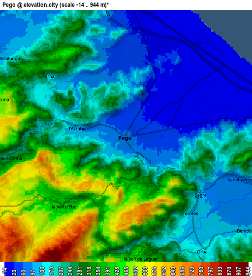
Below is the Elevation map of Pego, which displays elevation range with different colors. Scale of the first map is from -3 to 668 m (-10 to 2192 ft) with average elevation of 188.3 meters (=618 ft) [note 1]
These maps also provides idea of topography and contour of this city, they are displayed at different zoom levels. More info about maps, scale and edge coordinates you can find below images.
| \ | Map #1 | Map #2 | Topo.Map |
| Scale [m] | -3..668 m | -14..944 m | × |
| Scale [ft] | -10..2192 ft | -46..3097 ft | × |
| Average | 188.3 m = 618 ft | 239 m = 784 ft | × |
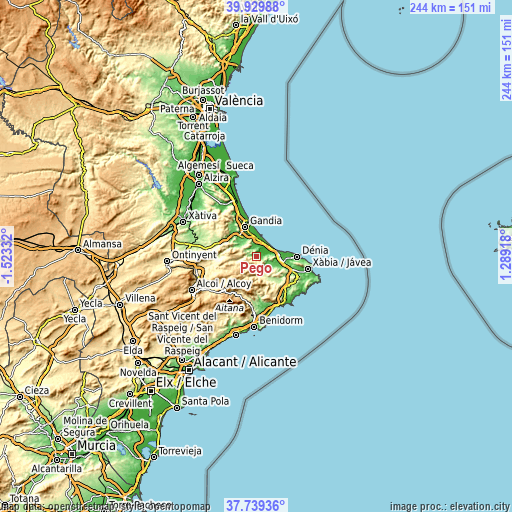
| Width | 7.61 km = 4.7 mi | 15.22 km = 9.5 mi | 243.6 km = 151.4 mi |
| Height | 7.61 km = 4.7 mi | 15.22 km = 9.5 mi | 243.6 km = 151.4 mi |
| ↑Max Latitude | 38.877269° | 38.911472° | 39.92988° |
| Latitude at center | 38.84305° | 38.84305° | 38.84305° |
| ↓Min Latitude | 38.808814° | 38.774562° | 37.73936° |
| ← Min Longitude | -0.161015° | -0.204961° | -1.52332° |
| Longitude center | -0.11707° | -0.11707° | -0.11707° |
| →Max Longitude | -0.073125° | -0.029179° | 1.28918° |
Nearby cities:
Cities around Pego sort by population:
• Oliva elevation 22 m
8.5 km,  358°
358°
• Villalonga 107 m
9.2 km,  301°
301°
• Orba 163 m
8.4 km,  145°
145°
• Beniarbeig 45 m
10.2 km,  103°
103°
• Benidoleig 111 m
9.4 km,  126°
126°
• Adsubia 108 m
3.2 km,  280°
280°
• Sanet y Negrals 94 m
7.6 km,  109°
109°
• Murla 285 m
9.7 km,  161°
161°
• Sagra 111 m
5.7 km, 128°
• Vall de Ebo 396 m
5.5 km,  221°
221°
• Tormos 127 m
6.1 km,  139°
139°
• Benimeli 95 m
6.8 km, 108°
Multilingual:
 En español:
Pego elevación 80 m.
 En France:
Pego élévation 80 m.


Sources and notes:
- [note 1] Map square and city borders are not equal. Map elevation data is calculated only from area inside that square.
- [src 1] Elevation data from geonames database provided with same terms of usage.
- [src 2] The elevation map of Pego is generated using elevation data from NASA's 3 arcsec (90m) resolution SRTM data.
- [src 3] Base (background) map © OpenStreetMap contributors tiles are generated by Geofabrik and OpenTopoMap.
Copyright & License:
This Pego Elevation Map is licensed under CC BY-SA. You may reuse any part from this page, if you give a proper credit by linking to this URL:
 More info on terms of use page.