Villalonga elevation
Villalonga (Valencia, Província de València), Spain elevation is 107 meters and Villalonga elevation in feet is 351 ft above sea level [src 1]. Villalonga is a seat of a third-order administrative division (feature code) with elevation that is 496 meters (1627 ft) smaller than average city elevation in Spain.
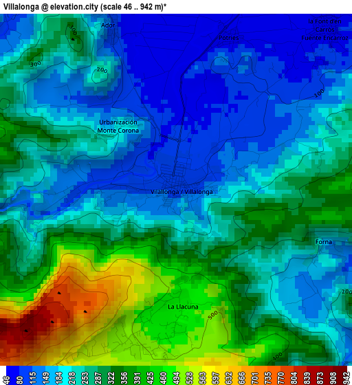
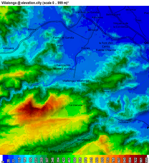
Below is the Elevation map of Villalonga, which displays elevation range with different colors. Scale of the first map is from 46 to 942 m (151 to 3091 ft) with average elevation of 263.4 meters (=864 ft) [note 1]
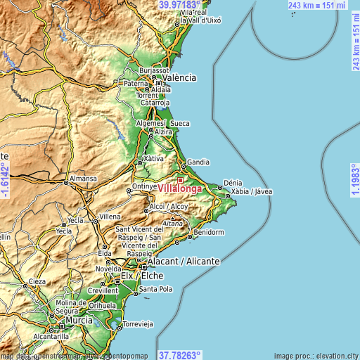
These maps also provides idea of topography and contour of this city, they are displayed at different zoom levels. More info about maps, scale and edge coordinates you can find below images.
| \ | Map #1 | Map #2 | Topo.Map |
| Scale [m] | 46..942 m | 0..999 m | × |
| Scale [ft] | 151..3091 ft | 0..3278 ft | × |
| Average | 263.4 m = 864 ft | 270.3 m = 887 ft | × |
| Width | 7.61 km = 4.7 mi | 15.21 km = 9.5 mi | 243.4 km = 151.2 mi |
| Height | 7.61 km = 4.7 mi | 15.21 km = 9.5 mi | 243.4 km = 151.2 mi |
| ↑Max Latitude | 38.919859° | 38.954041° | 39.97183° |
| Latitude at center | 38.88566° | 38.88566° | 38.88566° |
| ↓Min Latitude | 38.851445° | 38.817213° | 37.78263° |
| ← Min Longitude | -0.251895° | -0.295841° | -1.6142° |
| Longitude center | -0.20795° | -0.20795° | -0.20795° |
| →Max Longitude | -0.164005° | -0.120059° | 1.1983° |
Nearby cities:
Cities around Villalonga sort by population:
• Real de Gandía elevation 44 m
7.1 km,  10°
10°
• Almoines 40 m
6.8 km,  19°
19°
• Palma de Gandía 63 m
4.7 km,  346°
346°
• Beniarjó 48 m
5.5 km, 19°
• Rafelcofer 40 m
6.3 km,  33°
33°
• Ador 85 m
3.8 km,  340°
340°
• Rótova 108 m
6.7 km,  320°
320°
• Potríes 63 m
3.5 km, 17°
• Adsubia 108 m
6.3 km,  131°
131°
• Alfauir 80 m
6.4 km,  325°
325°
• Beniflá 43 m
5.4 km, 28°
• Castellonet de la Conquesta 196 m
6.1 km,  304°
304°
Multilingual:
 En español:
Villalonga elevación 107 m.
 En France:
Villalonga élévation 107 m.
 Auf Deutsch:
Villalonga höhe über dem Meeresspiegel ist 107 m.

Sources and notes:
- [note 1] Map square and city borders are not equal. Map elevation data is calculated only from area inside that square.
- [src 1] Elevation data from geonames database provided with same terms of usage.
- [src 2] The elevation map of Villalonga is generated using elevation data from NASA's 3 arcsec (90m) resolution SRTM data.
- [src 3] Base (background) map © OpenStreetMap contributors tiles are generated by Geofabrik and OpenTopoMap.
Copyright & License:
This Villalonga Elevation Map is licensed under CC BY-SA. You may reuse any part from this page, if you give a proper credit by linking to this URL:
 More info on terms of use page.