Alfántega elevation
Alfántega (Aragon, Provincia de Huesca), Spain elevation is 239 meters and Alfántega elevation in feet is 784 ft above sea level [src 1]. Alfántega is a seat of a third-order administrative division (feature code) with elevation that is 364 meters (1194 ft) smaller than average city elevation in Spain.
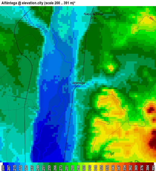
Below is the Elevation map of Alfántega, which displays elevation range with different colors. Scale of the first map is from 200 to 391 m (656 to 1283 ft) with average elevation of 257.9 meters (=846 ft) [note 1]
These maps also provides idea of topography and contour of this city, they are displayed at different zoom levels. More info about maps, scale and edge coordinates you can find below images.
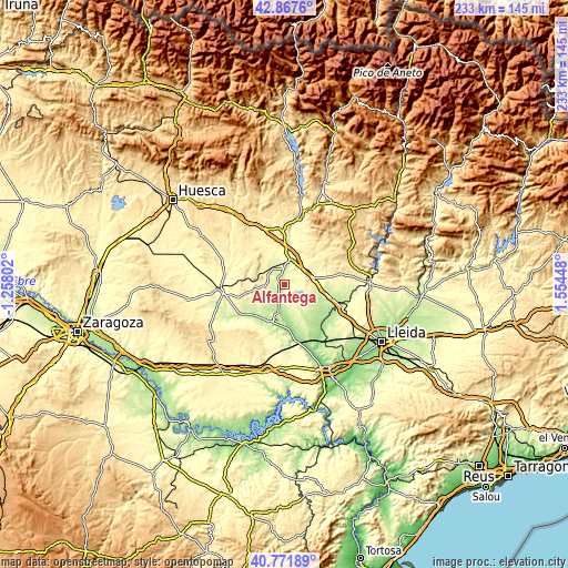
| \ | Map #1 | Topo.Map |
| Scale [m] | 200..391 m | × |
| Scale [ft] | 656..1283 ft | × |
| Average | 257.9 m = 846 ft | × |
| Width | 7.28 km = 4.5 mi | 233 km = 144.8 mi |
| Height | 7.28 km = 4.5 mi | 233 km = 144.8 mi |
| ↑Max Latitude | 41.861057° | 42.8676° |
| Latitude at center | 41.82832° | 41.82832° |
| ↓Min Latitude | 41.795566° | 40.77189° |
| ← Min Longitude | 0.104285° | -1.25802° |
| Longitude center | 0.14823° | 0.14823° |
| →Max Longitude | 0.192175° | 1.55448° |
Nearby cities:
Cities around Alfántega sort by population:
• Monzón elevation 280 m
9.9 km,  22°
22°
• Binéfar 285 m
12.4 km,  78°
78°
• Binaced 283 m
4.4 km,  93°
93°
• Belver de Cinca 202 m
15.3 km,  170°
170°
• Alcolea de Cinca 192 m
12.4 km,  192°
192°
• Albalate de Cinca 212 m
11.5 km,  178°
178°
• Esplús 277 m
11.1 km,  107°
107°
• Ontiñena 215 m
17.6 km,  196°
196°
• Castejón del Puente 358 m
14.9 km,  3°
3°
• Pueyo de Santa Cruz 249 m
3.4 km,  11°
11°
• Ilche 322 m
16.2 km,  332°
332°
• Castelflorite 311 m
14.4 km,  258°
258°
Multilingual:
 En español:
Alfántega elevación 239 m.
 En France:
Alfántega élévation 239 m.
 Auf Deutsch:
Alfántega höhe über dem Meeresspiegel ist 239 m.

Sources and notes:
- [note 1] Map square and city borders are not equal. Map elevation data is calculated only from area inside that square.
- [src 1] Elevation data from geonames database provided with same terms of usage.
- [src 2] The elevation map of Alfántega is generated using elevation data from NASA's 3 arcsec (90m) resolution SRTM data.
- [src 3] Base (background) map © OpenStreetMap contributors tiles are generated by Geofabrik and OpenTopoMap.
Copyright & License:
This Alfántega Elevation Map is licensed under CC BY-SA. You may reuse any part from this page, if you give a proper credit by linking to this URL:
 More info on terms of use page.