Ambía elevation
Ambía (Galicia, Provincia de Ourense), Spain elevation is 533 meters and Ambía elevation in feet is 1749 ft above sea level [src 1]. Ambía is a populated place (feature code) with elevation that is 70 meters (230 ft) smaller than average city elevation in Spain.
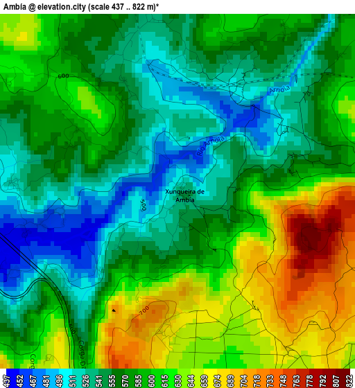
Below is the Elevation map of Ambía, which displays elevation range with different colors. Scale of the first map is from 437 to 822 m (1434 to 2697 ft) with average elevation of 583.4 meters (=1914 ft) [note 1]
These maps also provides idea of topography and contour of this city, they are displayed at different zoom levels. More info about maps, scale and edge coordinates you can find below images.
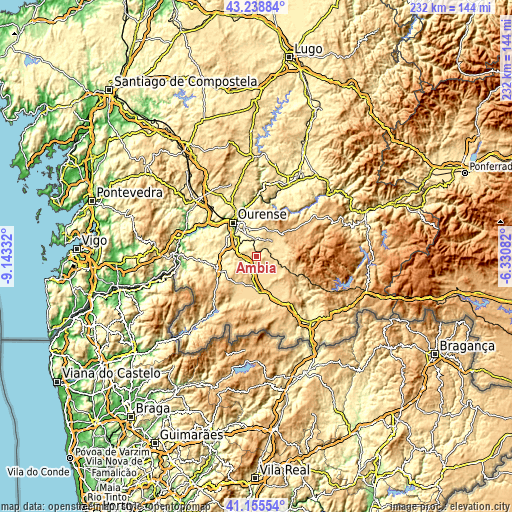
| \ | Map #1 | Topo.Map |
| Scale [m] | 437..822 m | × |
| Scale [ft] | 1434..2697 ft | × |
| Average | 583.4 m = 1914 ft | × |
| Width | 7.24 km = 4.5 mi | 231.6 km = 143.9 mi |
| Height | 7.24 km = 4.5 mi | 231.6 km = 143.9 mi |
| ↑Max Latitude | 42.238324° | 43.23884° |
| Latitude at center | 42.20578° | 42.20578° |
| ↓Min Latitude | 42.17322° | 41.15554° |
| ← Min Longitude | -7.781015° | -9.14332° |
| Longitude center | -7.73707° | -7.73707° |
| →Max Longitude | -7.693125° | -6.33082° |
Nearby cities:
Cities around Ambía sort by population:
• Ourense elevation 146 m
17.9 km,  324°
324°
• Xinzo de Limia 625 m
15.9 km,  176°
176°
• Celanova 515 m
18.9 km,  251°
251°
• Pereiro de Aguiar 327 m
16.4 km,  341°
341°
• Allariz 467 m
5.6 km, 252°
• Maceda 589 m
10.1 km,  45°
45°
• Baños de Molgas 514 m
6.7 km, 53°
• Rairiz de Veiga 621 m
15.8 km,  210°
210°
• Sarreaus 654 m
17.1 km,  139°
139°
• Taboadela 370 m
8.5 km,  298°
298°
• Esgos 581 m
13.7 km,  13°
13°
• Montederramo 906 m
20.9 km,  68°
68°
Multilingual:
 En español:
Ambía elevación 533 m.
 En France:
Ambía élévation 533 m.


Sources and notes:
- [note 1] Map square and city borders are not equal. Map elevation data is calculated only from area inside that square.
- [src 1] Elevation data from geonames database provided with same terms of usage.
- [src 2] The elevation map of Ambía is generated using elevation data from NASA's 3 arcsec (90m) resolution SRTM data.
- [src 3] Base (background) map © OpenStreetMap contributors tiles are generated by Geofabrik and OpenTopoMap.
Copyright & License:
This Ambía Elevation Map is licensed under CC BY-SA. You may reuse any part from this page, if you give a proper credit by linking to this URL:
 More info on terms of use page.