Autilla del Pino elevation
Autilla del Pino (Castille and León, Provincia de Palencia), Spain elevation is 869 meters and Autilla del Pino elevation in feet is 2851 ft above sea level [src 1]. Autilla del Pino is a seat of a third-order administrative division (feature code) with elevation that is 266 meters (873 ft) bigger than average city elevation in Spain.
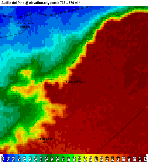
Below is the Elevation map of Autilla del Pino, which displays elevation range with different colors. Scale of the first map is from 737 to 876 m (2418 to 2874 ft) with average elevation of 824.5 meters (=2705 ft) [note 1]
These maps also provides idea of topography and contour of this city, they are displayed at different zoom levels. More info about maps, scale and edge coordinates you can find below images.
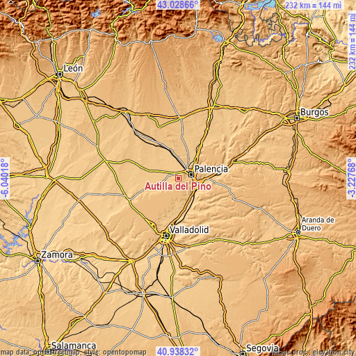
| \ | Map #1 | Topo.Map |
| Scale [m] | 737..876 m | × |
| Scale [ft] | 2418..2874 ft | × |
| Average | 824.5 m = 2705 ft | × |
| Width | 7.26 km = 4.5 mi | 232.4 km = 144.4 mi |
| Height | 7.26 km = 4.5 mi | 232.4 km = 144.4 mi |
| ↑Max Latitude | 42.024723° | 43.02866° |
| Latitude at center | 41.99207° | 41.99207° |
| ↓Min Latitude | 41.9594° | 40.93832° |
| ← Min Longitude | -4.677875° | -6.04018° |
| Longitude center | -4.63393° | -4.63393° |
| →Max Longitude | -4.589985° | -3.22768° |
Nearby cities:
Cities around Autilla del Pino sort by population:
• Palencia elevation 739 m
9.3 km,  77°
77°
• Villamuriel de Cerrato 726 m
10.9 km,  115°
115°
• Grijota 747 m
8 km,  31°
31°
• Villaumbrales 760 m
10.9 km,  8°
8°
• Villalobón 755 m
11.6 km,  68°
68°
• Mazariegos 740 m
7.8 km,  299°
299°
• Santa Cecilia del Alcor 858 m
6.9 km,  194°
194°
• Villamartín de Campos 748 m
3.6 km,  316°
316°
• Pedraza de Campos 755 m
8.4 km,  264°
264°
• Torremormojón 774 m
12.4 km,  253°
253°
• Baquerín de Campos 749 m
12.5 km,  282°
282°
• Rayaces 807 m
10.3 km,  220°
220°
Multilingual:
 En español:
Autilla del Pino elevación 869 m.
 En France:
Autilla del Pino élévation 869 m.
 Auf Deutsch:
Autilla del Pino höhe über dem Meeresspiegel ist 869 m.

Sources and notes:
- [note 1] Map square and city borders are not equal. Map elevation data is calculated only from area inside that square.
- [src 1] Elevation data from geonames database provided with same terms of usage.
- [src 2] The elevation map of Autilla del Pino is generated using elevation data from NASA's 3 arcsec (90m) resolution SRTM data.
- [src 3] Base (background) map © OpenStreetMap contributors tiles are generated by Geofabrik and OpenTopoMap.
Copyright & License:
This Autilla del Pino Elevation Map is licensed under CC BY-SA. You may reuse any part from this page, if you give a proper credit by linking to this URL:
 More info on terms of use page.