Barruecopardo elevation
Barruecopardo (Castille and León, Provincia de Salamanca), Spain elevation is 710 meters and Barruecopardo elevation in feet is 2329 ft above sea level [src 1]. Barruecopardo is a seat of a third-order administrative division (feature code) with elevation that is 107 meters (351 ft) bigger than average city elevation in Spain.
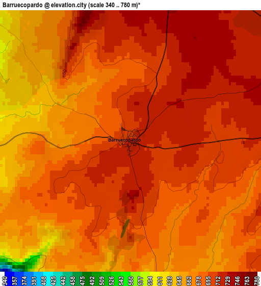
Below is the Elevation map of Barruecopardo, which displays elevation range with different colors. Scale of the first map is from 340 to 780 m (1115 to 2559 ft) with average elevation of 688.5 meters (=2259 ft) [note 1]
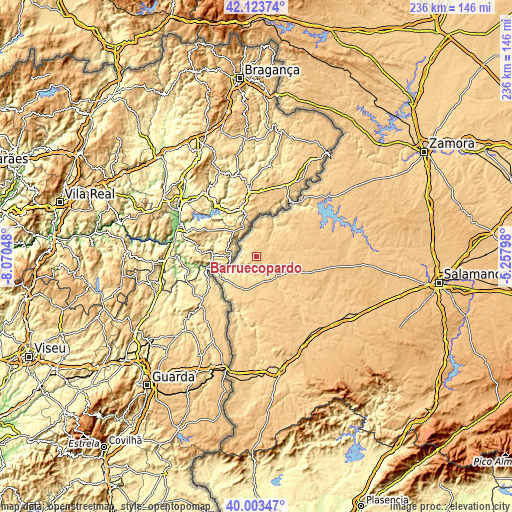
These maps also provides idea of topography and contour of this city, they are displayed at different zoom levels. More info about maps, scale and edge coordinates you can find below images.
| \ | Map #1 | Topo.Map |
| Scale [m] | 340..780 m | × |
| Scale [ft] | 1115..2559 ft | × |
| Average | 688.5 m = 2259 ft | × |
| Width | 7.37 km = 4.6 mi | 235.8 km = 146.5 mi |
| Height | 7.37 km = 4.6 mi | 235.7 km = 146.5 mi |
| ↑Max Latitude | 41.105271° | 42.12374° |
| Latitude at center | 41.07215° | 41.07215° |
| ↓Min Latitude | 41.039012° | 40.00347° |
| ← Min Longitude | -6.708175° | -8.07048° |
| Longitude center | -6.66423° | -6.66423° |
| →Max Longitude | -6.620285° | -5.25798° |
Nearby cities:
Cities around Barruecopardo sort by population:
• Vilvestre elevation 583 m
6.5 km,  305°
305°
• Cabeza del Caballo 740 m
11 km,  54°
54°
• Saucelle 666 m
7.9 km,  249°
249°
• Mieza 646 m
10.5 km,  347°
347°
• Villasbuenas 734 m
5.8 km,  100°
100°
• Encinasola de los Comendadores 711 m
12 km,  112°
112°
• Cerralbo 676 m
12.7 km,  149°
149°
• Bermellar 642 m
8.1 km,  183°
183°
• Valsalabroso 730 m
14.2 km,  72°
72°
• Valderrodrigo 734 m
13.1 km,  93°
93°
• Saldeana 664 m
6.1 km,  160°
160°
• Cerezal de Peñahorcada 704 m
6.6 km,  7°
7°
Multilingual:
 En español:
Barruecopardo elevación 710 m.
 En France:
Barruecopardo élévation 710 m.
 Auf Deutsch:
Barruecopardo höhe über dem Meeresspiegel ist 710 m.

Sources and notes:
- [note 1] Map square and city borders are not equal. Map elevation data is calculated only from area inside that square.
- [src 1] Elevation data from geonames database provided with same terms of usage.
- [src 2] The elevation map of Barruecopardo is generated using elevation data from NASA's 3 arcsec (90m) resolution SRTM data.
- [src 3] Base (background) map © OpenStreetMap contributors tiles are generated by Geofabrik and OpenTopoMap.
Copyright & License:
This Barruecopardo Elevation Map is licensed under CC BY-SA. You may reuse any part from this page, if you give a proper credit by linking to this URL:
 More info on terms of use page.