Bernardos elevation
Bernardos (Castille and León, Provincia de Segovia), Spain elevation is 905 meters and Bernardos elevation in feet is 2969 ft above sea level [src 1]. Bernardos is a seat of a third-order administrative division (feature code) with elevation that is 302 meters (991 ft) bigger than average city elevation in Spain.
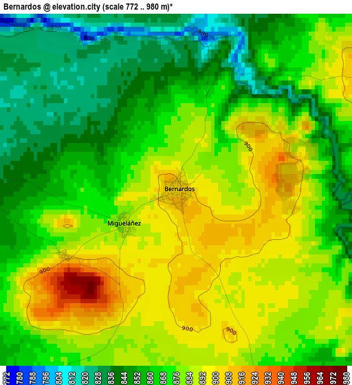
Below is the Elevation map of Bernardos, which displays elevation range with different colors. Scale of the first map is from 772 to 980 m (2533 to 3215 ft) with average elevation of 871 meters (=2858 ft) [note 1]
These maps also provides idea of topography and contour of this city, they are displayed at different zoom levels. More info about maps, scale and edge coordinates you can find below images.
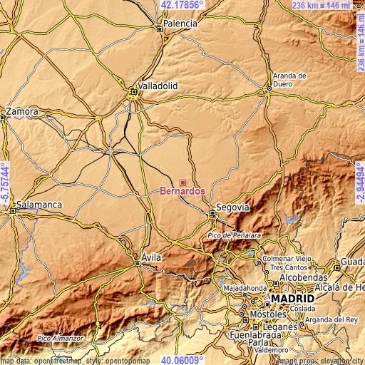
| \ | Map #1 | Topo.Map |
| Scale [m] | 772..980 m | × |
| Scale [ft] | 2533..3215 ft | × |
| Average | 871 m = 2858 ft | × |
| Width | 7.36 km = 4.6 mi | 235.6 km = 146.4 mi |
| Height | 7.36 km = 4.6 mi | 235.5 km = 146.3 mi |
| ↑Max Latitude | 41.160963° | 42.17856° |
| Latitude at center | 41.12787° | 41.12787° |
| ↓Min Latitude | 41.09476° | 40.06009° |
| ← Min Longitude | -4.395135° | -5.75744° |
| Longitude center | -4.35119° | -4.35119° |
| →Max Longitude | -4.307245° | -2.94494° |
Nearby cities:
Cities around Bernardos sort by population:
• Nava de la Asunción elevation 809 m
11.8 km,  285°
285°
• Carbonero el Mayor 915 m
7.3 km,  94°
94°
• Navas de Oro 808 m
10.5 km,  316°
316°
• Santa María la Real de Nieva 900 m
8 km,  216°
216°
• Nieva 841 m
8 km,  230°
230°
• Armuña 908 m
6.2 km,  154°
154°
• Yanguas de Eresma 895 m
11.3 km,  123°
123°
• Migueláñez 888 m
1.3 km,  236°
236°
• Añe 879 m
11.2 km, 154°
• Ortigosa de Pestaño 859 m
5.8 km, 219°
• Tabanera la Luenga 906 m
10 km,  110°
110°
• Domingo García 903 m
2.7 km, 239°
Multilingual:
 En español:
Bernardos elevación 905 m.
 En France:
Bernardos élévation 905 m.
 Auf Deutsch:
Bernardos höhe über dem Meeresspiegel ist 905 m.

Sources and notes:
- [note 1] Map square and city borders are not equal. Map elevation data is calculated only from area inside that square.
- [src 1] Elevation data from geonames database provided with same terms of usage.
- [src 2] The elevation map of Bernardos is generated using elevation data from NASA's 3 arcsec (90m) resolution SRTM data.
- [src 3] Base (background) map © OpenStreetMap contributors tiles are generated by Geofabrik and OpenTopoMap.
Copyright & License:
This Bernardos Elevation Map is licensed under CC BY-SA. You may reuse any part from this page, if you give a proper credit by linking to this URL:
 More info on terms of use page.