Blacos elevation
Blacos (Castille and León, Provincia de Soria), Spain elevation is 1000 meters and Blacos elevation in feet is 3281 ft above sea level [src 1]. Blacos is a seat of a third-order administrative division (feature code) with elevation that is 397 meters (1302 ft) bigger than average city elevation in Spain.
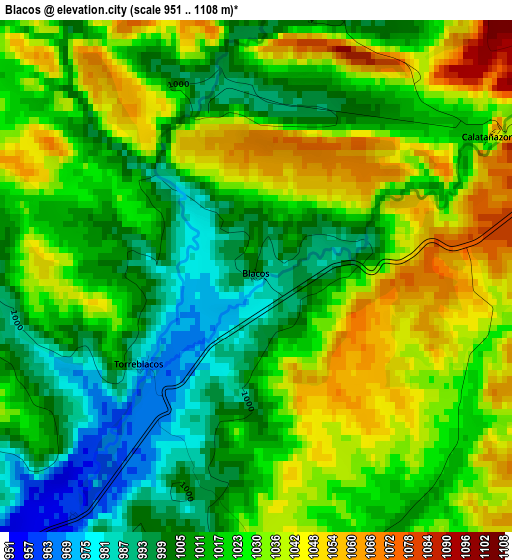
Below is the Elevation map of Blacos, which displays elevation range with different colors. Scale of the first map is from 951 to 1108 m (3120 to 3635 ft) with average elevation of 1021.5 meters (=3351 ft) [note 1]
These maps also provides idea of topography and contour of this city, they are displayed at different zoom levels. More info about maps, scale and edge coordinates you can find below images.
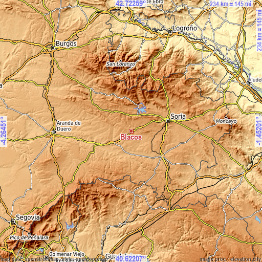
| \ | Map #1 | Topo.Map |
| Scale [m] | 951..1108 m | × |
| Scale [ft] | 3120..3635 ft | × |
| Average | 1021.5 m = 3351 ft | × |
| Width | 7.3 km = 4.5 mi | 233.6 km = 145.2 mi |
| Height | 7.3 km = 4.5 mi | 233.5 km = 145.1 mi |
| ↑Max Latitude | 41.713713° | 42.72259° |
| Latitude at center | 41.6809° | 41.6809° |
| ↓Min Latitude | 41.648071° | 40.62207° |
| ← Min Longitude | -2.902205° | -4.26451° |
| Longitude center | -2.85826° | -2.85826° |
| →Max Longitude | -2.814315° | -1.45201° |
Nearby cities:
Cities around Blacos sort by population:
• Cabrejas del Pinar elevation 1155 m
12.8 km,  3°
3°
• Abejar 1141 m
15.4 km,  23°
23°
• Valdemaluque 944 m
15.6 km,  267°
267°
• Valdenebro 940 m
15 km,  215°
215°
• Fuentepinilla 940 m
15 km,  147°
147°
• Valderrodilla 937 m
13.7 km,  162°
162°
• Muriel de la Fuente 1014 m
4.7 km,  358°
358°
• Bayubas de Arriba 961 m
13.9 km,  189°
189°
• Muriel Viejo 1089 m
12.3 km,  337°
337°
• Calatañazor 1063 m
3.9 km,  59°
59°
• Cubilla 1099 m
10 km,  319°
319°
• Torreblacos 980 m
2.1 km,  232°
232°
Multilingual:
 En español:
Blacos elevación 1000 m.
 En France:
Blacos élévation 1000 m.


Sources and notes:
- [note 1] Map square and city borders are not equal. Map elevation data is calculated only from area inside that square.
- [src 1] Elevation data from geonames database provided with same terms of usage.
- [src 2] The elevation map of Blacos is generated using elevation data from NASA's 3 arcsec (90m) resolution SRTM data.
- [src 3] Base (background) map © OpenStreetMap contributors tiles are generated by Geofabrik and OpenTopoMap.
Copyright & License:
This Blacos Elevation Map is licensed under CC BY-SA. You may reuse any part from this page, if you give a proper credit by linking to this URL:
 More info on terms of use page.