Brazuelo elevation
Brazuelo (Castille and León, Provincia de León), Spain elevation is 970 meters and Brazuelo elevation in feet is 3182 ft above sea level [src 1]. Brazuelo is a seat of a third-order administrative division (feature code) with elevation that is 367 meters (1204 ft) bigger than average city elevation in Spain.
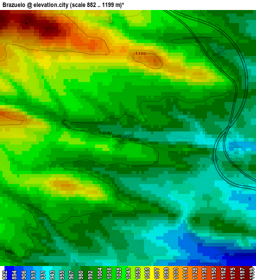
Below is the Elevation map of Brazuelo, which displays elevation range with different colors. Scale of the first map is from 882 to 1199 m (2894 to 3934 ft) with average elevation of 1007.8 meters (=3306 ft) [note 1]
These maps also provides idea of topography and contour of this city, they are displayed at different zoom levels. More info about maps, scale and edge coordinates you can find below images.
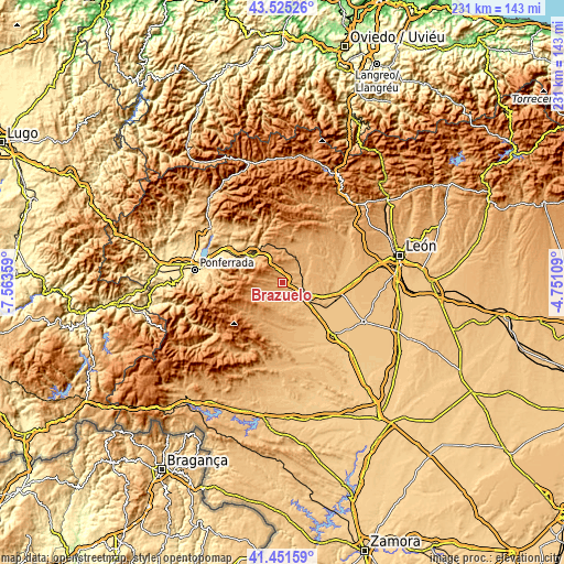
| \ | Map #1 | Topo.Map |
| Scale [m] | 882..1199 m | × |
| Scale [ft] | 2894..3934 ft | × |
| Average | 1007.8 m = 3306 ft | × |
| Width | 7.21 km = 4.5 mi | 230.6 km = 143.3 mi |
| Height | 7.21 km = 4.5 mi | 230.6 km = 143.3 mi |
| ↑Max Latitude | 42.529413° | 43.52526° |
| Latitude at center | 42.49702° | 42.49702° |
| ↓Min Latitude | 42.46461° | 41.45159° |
| ← Min Longitude | -6.201285° | -7.56359° |
| Longitude center | -6.15734° | -6.15734° |
| →Max Longitude | -6.113395° | -4.75109° |
Nearby cities:
Cities around Brazuelo sort by population:
• Astorga elevation 865 m
9.3 km,  117°
117°
• San Justo de la Vega 849 m
12.2 km,  111°
111°
• Riego de la Vega 807 m
18.6 km,  129°
129°
• Luyego 1051 m
15.8 km,  203°
203°
• Villamejil 911 m
13 km,  56°
56°
• Villagatón 1014 m
15.2 km,  358°
358°
• Val de San Lorenzo 893 m
9.2 km,  162°
162°
• Villaobispo de Otero 868 m
8.1 km,  87°
87°
• Valderrey 832 m
16 km,  135°
135°
• Santa Colomba de Somoza 1001 m
9.2 km,  230°
230°
• Magaz de Cepeda 896 m
8.5 km, 55°
• Santiago Millas 935 m
13.3 km, 161°
Multilingual:
 En español:
Brazuelo elevación 970 m.
 En France:
Brazuelo élévation 970 m.
 Auf Deutsch:
Brazuelo höhe über dem Meeresspiegel ist 970 m.

Sources and notes:
- [note 1] Map square and city borders are not equal. Map elevation data is calculated only from area inside that square.
- [src 1] Elevation data from geonames database provided with same terms of usage.
- [src 2] The elevation map of Brazuelo is generated using elevation data from NASA's 3 arcsec (90m) resolution SRTM data.
- [src 3] Base (background) map © OpenStreetMap contributors tiles are generated by Geofabrik and OpenTopoMap.
Copyright & License:
This Brazuelo Elevation Map is licensed under CC BY-SA. You may reuse any part from this page, if you give a proper credit by linking to this URL:
 More info on terms of use page.