Calzada del Coto elevation
Calzada del Coto (Castille and León, Provincia de León), Spain elevation is 823 meters and Calzada del Coto elevation in feet is 2700 ft above sea level [src 1]. Calzada del Coto is a seat of a third-order administrative division (feature code) with elevation that is 220 meters (722 ft) bigger than average city elevation in Spain.
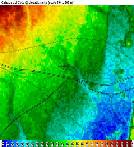
Below is the Elevation map of Calzada del Coto, which displays elevation range with different colors. Scale of the first map is from 794 to 866 m (2605 to 2841 ft) with average elevation of 821.5 meters (=2695 ft) [note 1]
These maps also provides idea of topography and contour of this city, they are displayed at different zoom levels. More info about maps, scale and edge coordinates you can find below images.
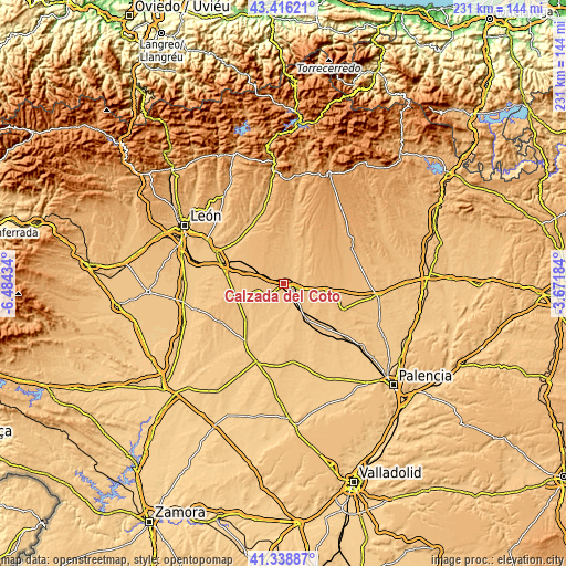
| \ | Map #1 | Topo.Map |
| Scale [m] | 794..866 m | × |
| Scale [ft] | 2605..2841 ft | × |
| Average | 821.5 m = 2695 ft | × |
| Width | 7.22 km = 4.5 mi | 231 km = 143.5 mi |
| Height | 7.22 km = 4.5 mi | 231 km = 143.5 mi |
| ↑Max Latitude | 42.41858° | 43.41621° |
| Latitude at center | 42.38613° | 42.38613° |
| ↓Min Latitude | 42.353663° | 41.33887° |
| ← Min Longitude | -5.122035° | -6.48434° |
| Longitude center | -5.07809° | -5.07809° |
| →Max Longitude | -5.034145° | -3.67184° |
Nearby cities:
Cities around Calzada del Coto sort by population:
• Sahagún elevation 828 m
4.3 km,  113°
113°
• Joarilla de las Matas 796 m
13.7 km,  216°
216°
• Santa María del Monte de Cea 886 m
12.1 km,  344°
344°
• Gordaliza del Pino 824 m
8 km,  233°
233°
• Grajal de Campos 805 m
8.7 km,  146°
146°
• Melgar de Arriba 793 m
13.2 km,  186°
186°
• Villamol 822 m
5.2 km,  27°
27°
• Bercianos del Real Camino 856 m
5.5 km,  271°
271°
• Vallecillo 842 m
11.4 km,  252°
252°
• Lagartos 916 m
14.4 km,  81°
81°
• Moratinos 860 m
12.6 km,  102°
102°
• Escobar de Campos 818 m
12.3 km,  131°
131°
Multilingual:
 En español:
Calzada del Coto elevación 823 m.
 En France:
Calzada del Coto élévation 823 m.
 Auf Deutsch:
Calzada del Coto höhe über dem Meeresspiegel ist 823 m.

Sources and notes:
- [note 1] Map square and city borders are not equal. Map elevation data is calculated only from area inside that square.
- [src 1] Elevation data from geonames database provided with same terms of usage.
- [src 2] The elevation map of Calzada del Coto is generated using elevation data from NASA's 3 arcsec (90m) resolution SRTM data.
- [src 3] Base (background) map © OpenStreetMap contributors tiles are generated by Geofabrik and OpenTopoMap.
Copyright & License:
This Calzada del Coto Elevation Map is licensed under CC BY-SA. You may reuse any part from this page, if you give a proper credit by linking to this URL:
 More info on terms of use page.