Cazalegas elevation
Cazalegas (Castille-La Mancha, Province of Toledo), Spain elevation is 443 meters and Cazalegas elevation in feet is 1453 ft above sea level [src 1]. Cazalegas is a seat of a third-order administrative division (feature code) with elevation that is 160 meters (525 ft) smaller than average city elevation in Spain.
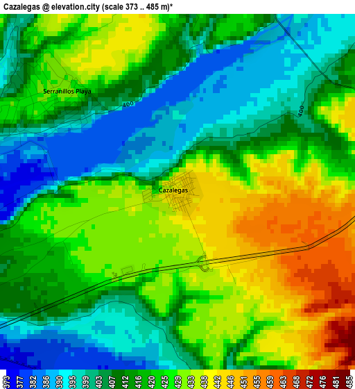
Below is the Elevation map of Cazalegas, which displays elevation range with different colors. Scale of the first map is from 373 to 485 m (1224 to 1591 ft) with average elevation of 417.9 meters (=1371 ft) [note 1]
These maps also provides idea of topography and contour of this city, they are displayed at different zoom levels. More info about maps, scale and edge coordinates you can find below images.
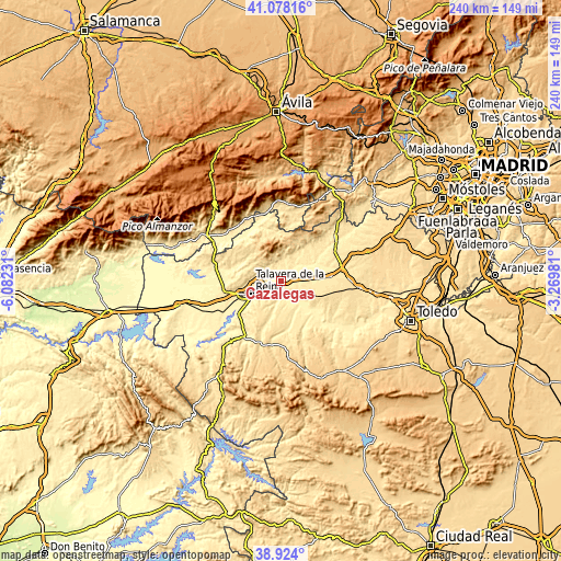
| \ | Map #1 | Topo.Map |
| Scale [m] | 373..485 m | × |
| Scale [ft] | 1224..1591 ft | × |
| Average | 417.9 m = 1371 ft | × |
| Width | 7.49 km = 4.7 mi | 239.5 km = 148.8 mi |
| Height | 7.49 km = 4.7 mi | 239.5 km = 148.8 mi |
| ↑Max Latitude | 40.043231° | 41.07816° |
| Latitude at center | 40.00958° | 40.00958° |
| ↓Min Latitude | 39.975912° | 38.924° |
| ← Min Longitude | -4.720005° | -6.08231° |
| Longitude center | -4.67606° | -4.67606° |
| →Max Longitude | -4.632115° | -3.26981° |
Nearby cities:
Cities around Cazalegas sort by population:
• Cebolla elevation 444 m
11.2 km,  127°
127°
• La Pueblanueva 482 m
10.8 km,  181°
181°
• El Casar de Escalona 466 m
13.5 km,  72°
72°
• Castillo de Bayuela 547 m
10.1 km,  355°
355°
• Montearagón 432 m
6.3 km,  143°
143°
• Hinojosa de San Vicente 656 m
11.3 km,  339°
339°
• Lucillos 481 m
6 km,  116°
116°
• Cervera de los Montes 535 m
12.4 km,  292°
292°
• Cardiel de los Montes 405 m
6.3 km,  16°
16°
• Otero 465 m
13.7 km,  94°
94°
• Nuño Gómez 472 m
12.5 km, 22°
• Illán de Vacas 480 m
11 km,  113°
113°
Multilingual:
 En español:
Cazalegas elevación 443 m.
 En France:
Cazalegas élévation 443 m.
 Auf Deutsch:
Cazalegas höhe über dem Meeresspiegel ist 443 m.

Sources and notes:
- [note 1] Map square and city borders are not equal. Map elevation data is calculated only from area inside that square.
- [src 1] Elevation data from geonames database provided with same terms of usage.
- [src 2] The elevation map of Cazalegas is generated using elevation data from NASA's 3 arcsec (90m) resolution SRTM data.
- [src 3] Base (background) map © OpenStreetMap contributors tiles are generated by Geofabrik and OpenTopoMap.
Copyright & License:
This Cazalegas Elevation Map is licensed under CC BY-SA. You may reuse any part from this page, if you give a proper credit by linking to this URL:
 More info on terms of use page.