Cintruénigo elevation
Cintruénigo (Navarre, Provincia de Navarra), Spain elevation is 400 meters and Cintruénigo elevation in feet is 1312 ft above sea level [src 1]. Cintruénigo is a seat of a third-order administrative division (feature code) with elevation that is 203 meters (666 ft) smaller than average city elevation in Spain.
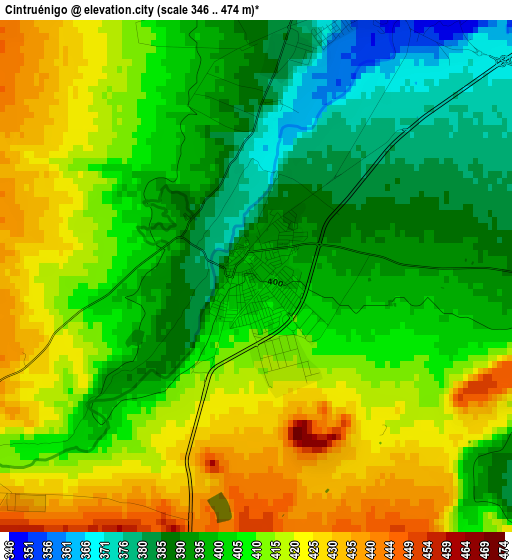
Below is the Elevation map of Cintruénigo, which displays elevation range with different colors. Scale of the first map is from 346 to 474 m (1135 to 1555 ft) with average elevation of 406.3 meters (=1333 ft) [note 1]
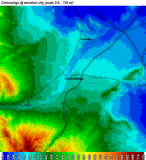
These maps also provides idea of topography and contour of this city, they are displayed at different zoom levels. More info about maps, scale and edge coordinates you can find below images.
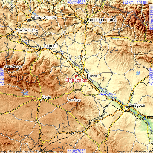
| \ | Map #1 | Map #2 | Topo.Map |
| Scale [m] | 346..474 m | 314..730 m | × |
| Scale [ft] | 1135..1555 ft | 1030..2395 ft | × |
| Average | 406.3 m = 1333 ft | 424.9 m = 1394 ft | × |
| Width | 7.25 km = 4.5 mi | 14.51 km = 9 mi | 232.1 km = 144.2 mi |
| Height | 7.25 km = 4.5 mi | 14.51 km = 9 mi | 232.1 km = 144.2 mi |
| ↑Max Latitude | 42.111979° | 42.14457° | 43.11452° |
| Latitude at center | 42.07937° | 42.07937° | 42.07937° |
| ↓Min Latitude | 42.046745° | 42.014103° | 41.02705° |
| ← Min Longitude | -1.848525° | -1.892471° | -3.21083° |
| Longitude center | -1.80458° | -1.80458° | -1.80458° |
| →Max Longitude | -1.760635° | -1.716689° | -0.39833° |
Nearby cities:
Cities around Cintruénigo sort by population:
• Tudela elevation 266 m
16.6 km,  96°
96°
• Alfaro 298 m
12.1 km,  21°
21°
• Corella 380 m
4.3 km, 21°
• Castejón 278 m
13.8 km,  43°
43°
• Murchante 323 m
13.4 km,  113°
113°
• Cervera del Río Alhama 539 m
14.9 km,  236°
236°
• Fitero 427 m
5 km, 241°
• Novallas 428 m
16.8 km,  149°
149°
• Grávalos 738 m
16.3 km,  281°
281°
• Tulebras 375 m
15.6 km,  137°
137°
• Monteagudo 386 m
16 km, 141°
• Cascante 371 m
13.7 km,  131°
131°
Multilingual:
 En español:
Cintruénigo elevación 400 m.
 En France:
Cintruénigo élévation 400 m.
 Auf Deutsch:
Cintruénigo höhe über dem Meeresspiegel ist 400 m.

Sources and notes:
- [note 1] Map square and city borders are not equal. Map elevation data is calculated only from area inside that square.
- [src 1] Elevation data from geonames database provided with same terms of usage.
- [src 2] The elevation map of Cintruénigo is generated using elevation data from NASA's 3 arcsec (90m) resolution SRTM data.
- [src 3] Base (background) map © OpenStreetMap contributors tiles are generated by Geofabrik and OpenTopoMap.
Copyright & License:
This Cintruénigo Elevation Map is licensed under CC BY-SA. You may reuse any part from this page, if you give a proper credit by linking to this URL:
 More info on terms of use page.