Cunit elevation
Cunit (Catalonia, Província de Tarragona), Spain elevation is 12 meters and Cunit elevation in feet is 39 ft above sea level [src 1]. Cunit is a seat of a third-order administrative division (feature code) with elevation that is 591 meters (1939 ft) smaller than average city elevation in Spain.
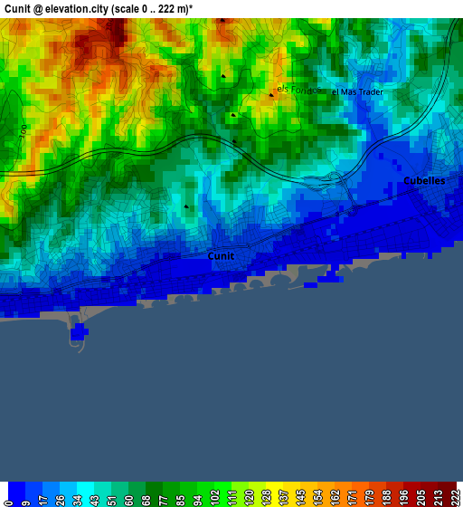
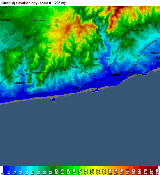
Below is the Elevation map of Cunit, which displays elevation range with different colors. Scale of the first map is from 0 to 222 m (0 to 728 ft) with average elevation of 66.6 meters (=219 ft) [note 1]
These maps also provides idea of topography and contour of this city, they are displayed at different zoom levels. More info about maps, scale and edge coordinates you can find below images.
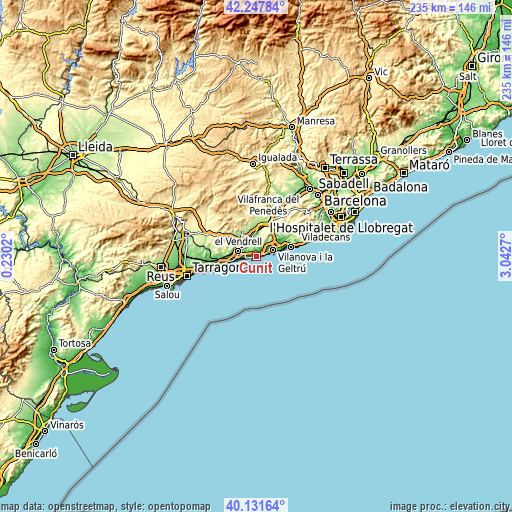
| \ | Map #1 | Map #2 | Topo.Map |
| Scale [m] | 0..222 m | 0..298 m | × |
| Scale [ft] | 0..728 ft | 0..978 ft | × |
| Average | 66.6 m = 219 ft | 95 m = 312 ft | × |
| Width | 7.35 km = 4.6 mi | 14.71 km = 9.1 mi | 235.3 km = 146.2 mi |
| Height | 7.35 km = 4.6 mi | 14.71 km = 9.1 mi | 235.3 km = 146.2 mi |
| ↑Max Latitude | 41.231348° | 41.264389° | 42.24784° |
| Latitude at center | 41.19829° | 41.19829° | 41.19829° |
| ↓Min Latitude | 41.165216° | 41.132125° | 40.13164° |
| ← Min Longitude | 1.592505° | 1.548559° | 0.2302° |
| Longitude center | 1.63645° | 1.63645° | 1.63645° |
| →Max Longitude | 1.680395° | 1.724341° | 3.0427° |
Nearby cities:
Cities around Cunit sort by population:
• Vilanova i la Geltrú elevation 25 m
7.9 km,  68°
68°
• El Vendrell 41 m
8.9 km,  283°
283°
• Sant Pere de Ribes 50 m
13.4 km,  58°
58°
• Sitges 18 m
15.2 km, 74°
• Calafell 46 m
5.7 km,  271°
271°
• Cubelles 13 m
3.2 km, 70°
• Castellet 114 m
7.2 km,  358°
358°
• Roda de Barà 60 m
14.9 km,  264°
264°
• Coma-ruga 2 m
9.5 km, 257°
• Santa Oliva 103 m
9.4 km,  310°
310°
• Albinyana 216 m
14 km,  294°
294°
• Sant Jaume dels Domenys 197 m
12.7 km,  332°
332°
Multilingual:
 En español:
Cunit elevación 12 m.
 En France:
Cunit élévation 12 m.


Sources and notes:
- [note 1] Map square and city borders are not equal. Map elevation data is calculated only from area inside that square.
- [src 1] Elevation data from geonames database provided with same terms of usage.
- [src 2] The elevation map of Cunit is generated using elevation data from NASA's 3 arcsec (90m) resolution SRTM data.
- [src 3] Base (background) map © OpenStreetMap contributors tiles are generated by Geofabrik and OpenTopoMap.
Copyright & License:
This Cunit Elevation Map is licensed under CC BY-SA. You may reuse any part from this page, if you give a proper credit by linking to this URL:
 More info on terms of use page.