Fogars de Montclús elevation
Fogars de Montclús (Catalonia, Província de Barcelona), Spain elevation is 532 meters and Fogars de Montclús elevation in feet is 1745 ft above sea level [src 1]. Fogars de Montclús is a seat of a third-order administrative division (feature code) with elevation that is 71 meters (233 ft) smaller than average city elevation in Spain.
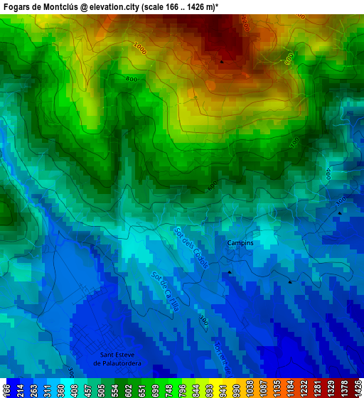
Below is the Elevation map of Fogars de Montclús, which displays elevation range with different colors. Scale of the first map is from 166 to 1426 m (545 to 4678 ft) with average elevation of 529.9 meters (=1739 ft) [note 1]
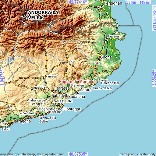
These maps also provides idea of topography and contour of this city, they are displayed at different zoom levels. More info about maps, scale and edge coordinates you can find below images.
| \ | Map #1 | Topo.Map |
| Scale [m] | 166..1426 m | × |
| Scale [ft] | 545..4678 ft | × |
| Average | 529.9 m = 1739 ft | × |
| Width | 7.29 km = 4.5 mi | 233.4 km = 145 mi |
| Height | 7.29 km = 4.5 mi | 233.4 km = 145 mi |
| ↑Max Latitude | 41.766116° | 42.77416° |
| Latitude at center | 41.73333° | 41.73333° |
| ↓Min Latitude | 41.700527° | 40.67535° |
| ← Min Longitude | 2.406055° | 1.04375° |
| Longitude center | 2.45° | 2.45° |
| →Max Longitude | 2.493945° | 3.85625° |
Nearby cities:
Cities around Fogars de Montclús sort by population:
• Sant Celoni elevation 162 m
5.9 km,  146°
146°
• Cardedeu 199 m
12.9 km,  216°
216°
• Santa Maria de Palautordera 204 m
4.4 km,  184°
184°
• Breda 169 m
9.2 km,  79°
79°
• Cànoves i Samalús 357 m
10 km,  236°
236°
• Vallgorguina 222 m
10.7 km, 152°
• Viladrau 826 m
13.6 km,  338°
338°
• Campins 255 m
2.3 km,  143°
143°
• Llinars del Vallès 181 m
11.9 km,  200°
200°
• Arbúcies 285 m
10.8 km,  30°
30°
• Sant Pere de Vilamajor 318 m
7.8 km, 224°
• Riells i Viabrea 573 m
7.8 km,  44°
44°
Multilingual:
 En español:
Fogás de Monclús elevación 532 m.
 En France:
Fogars de Montclús élévation 532 m.
 Auf Deutsch:
Fogars de Montclús höhe über dem Meeresspiegel ist 532 m.
 На русском:
Fogars de Montclús высота над уровнем моря 532 м
Sources and notes:
- [note 1] Map square and city borders are not equal. Map elevation data is calculated only from area inside that square.
- [src 1] Elevation data from geonames database provided with same terms of usage.
- [src 2] The elevation map of Fogars de Montclús is generated using elevation data from NASA's 3 arcsec (90m) resolution SRTM data.
- [src 3] Base (background) map © OpenStreetMap contributors tiles are generated by Geofabrik and OpenTopoMap.
Copyright & License:
This Fogars de Montclús Elevation Map is licensed under CC BY-SA. You may reuse any part from this page, if you give a proper credit by linking to this URL:
 More info on terms of use page.