Fuentesoto elevation
Fuentesoto (Castille and León, Provincia de Segovia), Spain elevation is 938 meters and Fuentesoto elevation in feet is 3077 ft above sea level [src 1]. Fuentesoto is a seat of a third-order administrative division (feature code) with elevation that is 335 meters (1099 ft) bigger than average city elevation in Spain.
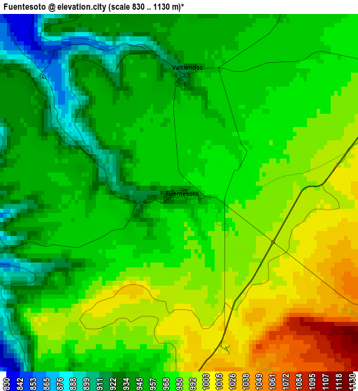
Below is the Elevation map of Fuentesoto, which displays elevation range with different colors. Scale of the first map is from 830 to 1130 m (2723 to 3707 ft) with average elevation of 968.4 meters (=3177 ft) [note 1]
These maps also provides idea of topography and contour of this city, they are displayed at different zoom levels. More info about maps, scale and edge coordinates you can find below images.
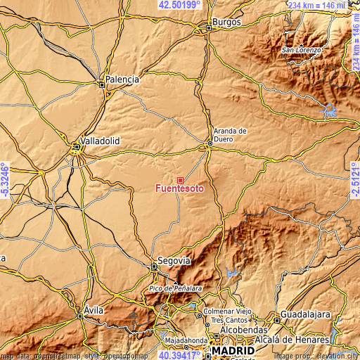
| \ | Map #1 | Topo.Map |
| Scale [m] | 830..1130 m | × |
| Scale [ft] | 2723..3707 ft | × |
| Average | 968.4 m = 3177 ft | × |
| Width | 7.32 km = 4.5 mi | 234.4 km = 145.6 mi |
| Height | 7.32 km = 4.5 mi | 234.4 km = 145.6 mi |
| ↑Max Latitude | 41.489567° | 42.50199° |
| Latitude at center | 41.45664° | 41.45664° |
| ↓Min Latitude | 41.423697° | 40.39417° |
| ← Min Longitude | -3.962295° | -5.3246° |
| Longitude center | -3.91835° | -3.91835° |
| →Max Longitude | -3.874405° | -2.5121° |
Nearby cities:
Cities around Fuentesoto sort by population:
• Sacramenia elevation 834 m
5.5 km,  318°
318°
• Cuevas de Provanco 889 m
10.2 km,  339°
339°
• Fuentidueña 832 m
5.3 km,  252°
252°
• Valtiendas 914 m
2.4 km,  1°
1°
• Laguna de Contreras 800 m
10.1 km,  294°
294°
• Fuente el Olmo de Fuentidueña 851 m
11 km,  218°
218°
• Torreadrada 1082 m
6.7 km,  101°
101°
• Aldeasoña 850 m
11.7 km,  278°
278°
• Castro de Fuentidueña 1099 m
6.6 km,  127°
127°
• Cobos de Fuentidueña 837 m
8.3 km,  185°
185°
• Castrojimeno 1075 m
8.9 km,  138°
138°
• Carrascal del Río 855 m
10 km,  170°
170°
Multilingual:
 En español:
Fuentesoto elevación 938 m.
 En France:
Fuentesoto élévation 938 m.
 Auf Deutsch:
Fuentesoto höhe über dem Meeresspiegel ist 938 m.

Sources and notes:
- [note 1] Map square and city borders are not equal. Map elevation data is calculated only from area inside that square.
- [src 1] Elevation data from geonames database provided with same terms of usage.
- [src 2] The elevation map of Fuentesoto is generated using elevation data from NASA's 3 arcsec (90m) resolution SRTM data.
- [src 3] Base (background) map © OpenStreetMap contributors tiles are generated by Geofabrik and OpenTopoMap.
Copyright & License:
This Fuentesoto Elevation Map is licensed under CC BY-SA. You may reuse any part from this page, if you give a proper credit by linking to this URL:
 More info on terms of use page.