Gargüera elevation
Gargüera (Extremadura, Provincia de Cáceres), Spain elevation is 524 meters and Gargüera elevation in feet is 1719 ft above sea level [src 1]. Gargüera is a seat of a third-order administrative division (feature code) with elevation that is 79 meters (259 ft) smaller than average city elevation in Spain.
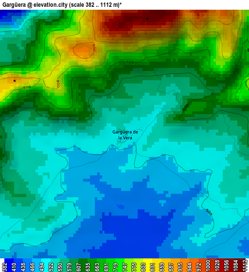
Below is the Elevation map of Gargüera, which displays elevation range with different colors. Scale of the first map is from 382 to 1112 m (1253 to 3648 ft) with average elevation of 592.6 meters (=1944 ft) [note 1]
These maps also provides idea of topography and contour of this city, they are displayed at different zoom levels. More info about maps, scale and edge coordinates you can find below images.
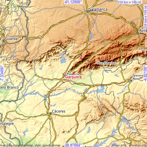
| \ | Map #1 | Topo.Map |
| Scale [m] | 382..1112 m | × |
| Scale [ft] | 1253..3648 ft | × |
| Average | 592.6 m = 1944 ft | × |
| Width | 7.48 km = 4.6 mi | 239.3 km = 148.7 mi |
| Height | 7.48 km = 4.6 mi | 239.3 km = 148.7 mi |
| ↑Max Latitude | 40.094926° | 41.12906° |
| Latitude at center | 40.0613° | 40.0613° |
| ↓Min Latitude | 40.027658° | 38.97654° |
| ← Min Longitude | -5.971755° | -7.33406° |
| Longitude center | -5.92781° | -5.92781° |
| →Max Longitude | -5.883865° | -4.52156° |
Nearby cities:
Cities around Gargüera sort by population:
• Malpartida de Plasencia elevation 457 m
13.6 km,  227°
227°
• Piornal 1181 m
9.2 km,  47°
47°
• Tejeda de Tiétar 439 m
6.9 km,  134°
134°
• Casas del Castañar 680 m
5.5 km,  20°
20°
• Torremenga 530 m
13.1 km,  97°
97°
• Arroyomolinos de la Vera 594 m
6.6 km, 98°
• Barrado 807 m
4.8 km,  56°
56°
• Cabezabellosa 864 m
10.5 km,  323°
323°
• Cabrero 730 m
6.5 km,  27°
27°
• Valdastillas 612 m
9 km, 27°
• Villar de Plasencia 473 m
12 km,  314°
314°
• Jarilla 492 m
13.8 km,  332°
332°
Multilingual:
 En español:
Gargüera elevación 524 m.
 En France:
Gargüera élévation 524 m.
 Auf Deutsch:
Gargüera höhe über dem Meeresspiegel ist 524 m.

Sources and notes:
- [note 1] Map square and city borders are not equal. Map elevation data is calculated only from area inside that square.
- [src 1] Elevation data from geonames database provided with same terms of usage.
- [src 2] The elevation map of Gargüera is generated using elevation data from NASA's 3 arcsec (90m) resolution SRTM data.
- [src 3] Base (background) map © OpenStreetMap contributors tiles are generated by Geofabrik and OpenTopoMap.
Copyright & License:
This Gargüera Elevation Map is licensed under CC BY-SA. You may reuse any part from this page, if you give a proper credit by linking to this URL:
 More info on terms of use page.