Gelida elevation
Gelida (Catalonia, Província de Barcelona), Spain elevation is 252 meters and Gelida elevation in feet is 827 ft above sea level [src 1]. Gelida is a seat of a third-order administrative division (feature code) with elevation that is 351 meters (1152 ft) smaller than average city elevation in Spain.
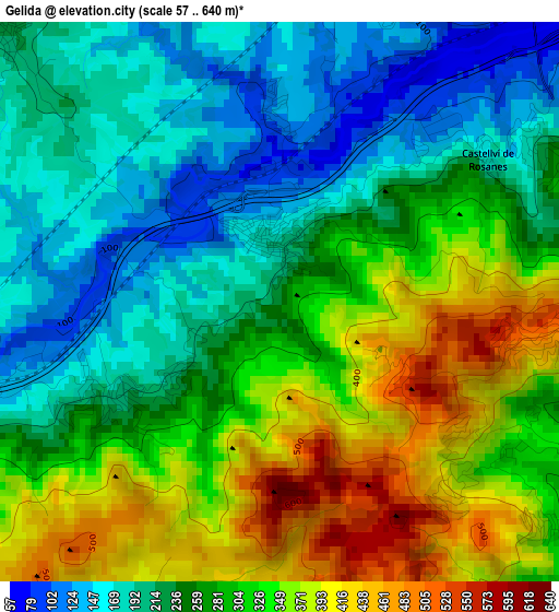
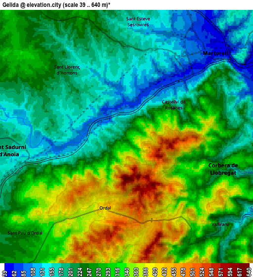
Below is the Elevation map of Gelida, which displays elevation range with different colors. Scale of the first map is from 57 to 640 m (187 to 2100 ft) with average elevation of 278.1 meters (=912 ft) [note 1]
These maps also provides idea of topography and contour of this city, they are displayed at different zoom levels. More info about maps, scale and edge coordinates you can find below images.
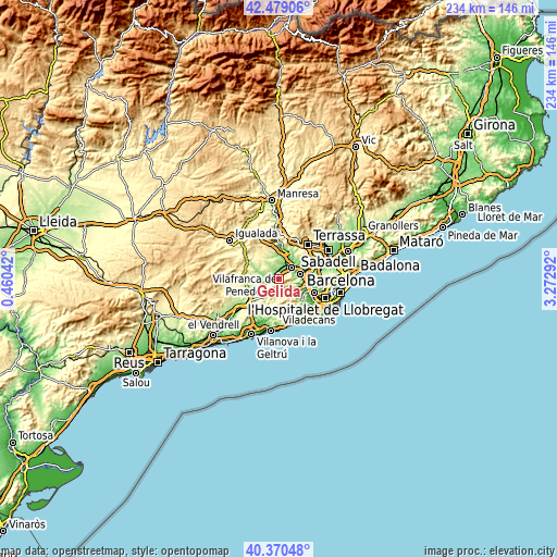
| \ | Map #1 | Map #2 | Topo.Map |
| Scale [m] | 57..640 m | 39..640 m | × |
| Scale [ft] | 187..2100 ft | 128..2100 ft | × |
| Average | 278.1 m = 912 ft | 259.8 m = 852 ft | × |
| Width | 7.33 km = 4.6 mi | 14.65 km = 9.1 mi | 234.5 km = 145.7 mi |
| Height | 7.33 km = 4.6 mi | 14.65 km = 9.1 mi | 234.4 km = 145.6 mi |
| ↑Max Latitude | 41.466269° | 41.49919° | 42.47906° |
| Latitude at center | 41.43333° | 41.43333° | 41.43333° |
| ↓Min Latitude | 41.400375° | 41.367403° | 40.37048° |
| ← Min Longitude | 1.822725° | 1.778779° | 0.46042° |
| Longitude center | 1.86667° | 1.86667° | 1.86667° |
| →Max Longitude | 1.910615° | 1.954561° | 3.27292° |
Nearby cities:
Cities around Gelida sort by population:
• Martorell elevation 71 m
7 km,  49°
49°
• Sant Andreu de la Barca 61 m
8.9 km,  80°
80°
• Vallirana 191 m
7.5 km,  133°
133°
• Corbera de Llobregat 327 m
4.8 km,  112°
112°
• Sant Sadurní d'Anoia 170 m
6.8 km,  262°
262°
• Abrera 111 m
9.7 km,  17°
17°
• Cervelló 119 m
8.8 km,  118°
118°
• Masquefa 257 m
9.1 km,  329°
329°
• Subirats 437 m
4.6 km,  216°
216°
• Olesa de Bonesvalls 276 m
8.9 km,  189°
189°
• Castellví de Rosanes 184 m
3.3 km,  56°
56°
• Sant Llorenç d'Hortons 169 m
4.6 km,  323°
323°
Multilingual:
 En español:
Gelida elevación 252 m.
 En France:
Gelida élévation 252 m.


Sources and notes:
- [note 1] Map square and city borders are not equal. Map elevation data is calculated only from area inside that square.
- [src 1] Elevation data from geonames database provided with same terms of usage.
- [src 2] The elevation map of Gelida is generated using elevation data from NASA's 3 arcsec (90m) resolution SRTM data.
- [src 3] Base (background) map © OpenStreetMap contributors tiles are generated by Geofabrik and OpenTopoMap.
Copyright & License:
This Gelida Elevation Map is licensed under CC BY-SA. You may reuse any part from this page, if you give a proper credit by linking to this URL:
 More info on terms of use page.