Subirats elevation
Subirats (Catalonia, Província de Barcelona), Spain elevation is 437 meters and Subirats elevation in feet is 1434 ft above sea level [src 1]. Subirats is a seat of a third-order administrative division (feature code) with elevation that is 166 meters (545 ft) smaller than average city elevation in Spain.
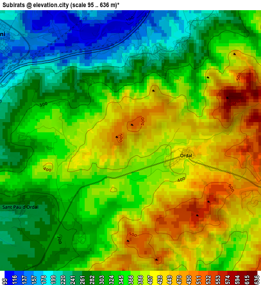
Below is the Elevation map of Subirats, which displays elevation range with different colors. Scale of the first map is from 95 to 636 m (312 to 2087 ft) with average elevation of 347.6 meters (=1140 ft) [note 1]
These maps also provides idea of topography and contour of this city, they are displayed at different zoom levels. More info about maps, scale and edge coordinates you can find below images.
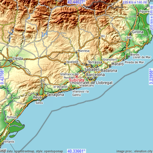
| \ | Map #1 | Topo.Map |
| Scale [m] | 95..636 m | × |
| Scale [ft] | 312..2087 ft | × |
| Average | 347.6 m = 1140 ft | × |
| Width | 7.33 km = 4.6 mi | 234.6 km = 145.8 mi |
| Height | 7.33 km = 4.6 mi | 234.6 km = 145.8 mi |
| ↑Max Latitude | 41.432956° | 42.44627° |
| Latitude at center | 41.4° | 41.4° |
| ↓Min Latitude | 41.367028° | 40.33661° |
| ← Min Longitude | 1.789385° | 0.42708° |
| Longitude center | 1.83333° | 1.83333° |
| →Max Longitude | 1.877275° | 3.23958° |
Nearby cities:
Cities around Subirats sort by population:
• Vallirana elevation 191 m
8.4 km,  100°
100°
• Corbera de Llobregat 327 m
7.4 km,  75°
75°
• Sant Sadurní d'Anoia 170 m
4.9 km,  305°
305°
• Cervelló 119 m
10.5 km,  92°
92°
• Gelida 252 m
4.6 km,  36°
36°
• Olivella 207 m
9.4 km,  188°
188°
• La Granada 273 m
9.8 km,  255°
255°
• Olesa de Bonesvalls 276 m
5.2 km,  165°
165°
• Castellví de Rosanes 184 m
7.9 km, 44°
• el Pla del Penedès 207 m
9.9 km,  280°
280°
• Sant Llorenç d'Hortons 169 m
7.4 km,  0°
0°
• Avinyonet del Penedès 352 m
7 km,  216°
216°
Multilingual:
 En español:
Subirats elevación 437 m.
 En France:
Subirats élévation 437 m.
 Auf Deutsch:
Subirats höhe über dem Meeresspiegel ist 437 m.

Sources and notes:
- [note 1] Map square and city borders are not equal. Map elevation data is calculated only from area inside that square.
- [src 1] Elevation data from geonames database provided with same terms of usage.
- [src 2] The elevation map of Subirats is generated using elevation data from NASA's 3 arcsec (90m) resolution SRTM data.
- [src 3] Base (background) map © OpenStreetMap contributors tiles are generated by Geofabrik and OpenTopoMap.
Copyright & License:
This Subirats Elevation Map is licensed under CC BY-SA. You may reuse any part from this page, if you give a proper credit by linking to this URL:
 More info on terms of use page.