Igualada elevation
Igualada (Catalonia, Província de Barcelona), Spain elevation is 322 meters and Igualada elevation in feet is 1056 ft above sea level [src 1]. Igualada is a populated place (feature code) with elevation that is 281 meters (922 ft) smaller than average city elevation in Spain.
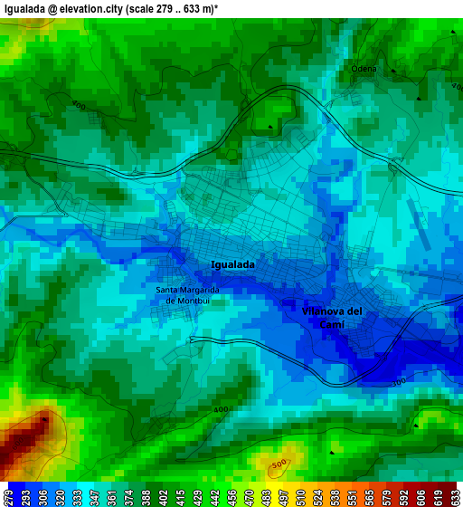
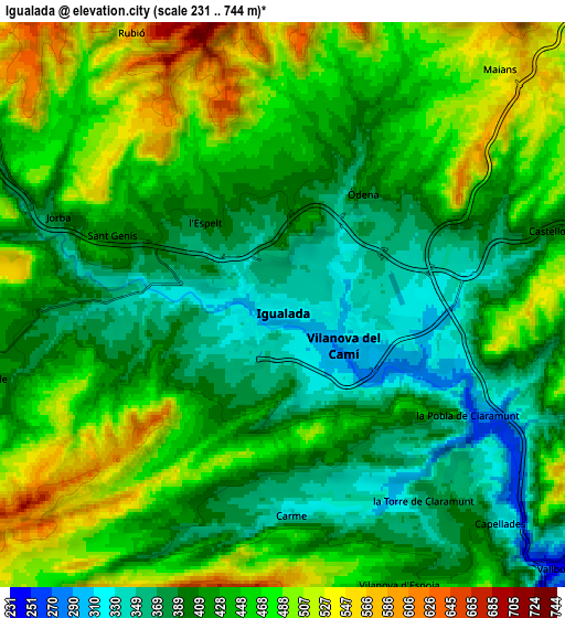
Below is the Elevation map of Igualada, which displays elevation range with different colors. Scale of the first map is from 279 to 633 m (915 to 2077 ft) with average elevation of 372.1 meters (=1221 ft) [note 1]
These maps also provides idea of topography and contour of this city, they are displayed at different zoom levels. More info about maps, scale and edge coordinates you can find below images.
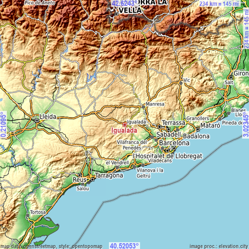
| \ | Map #1 | Map #2 | Topo.Map |
| Scale [m] | 279..633 m | 231..744 m | × |
| Scale [ft] | 915..2077 ft | 758..2441 ft | × |
| Average | 372.1 m = 1221 ft | 435.1 m = 1427 ft | × |
| Width | 7.31 km = 4.5 mi | 14.62 km = 9.1 mi | 233.9 km = 145.3 mi |
| Height | 7.31 km = 4.5 mi | 14.62 km = 9.1 mi | 233.9 km = 145.3 mi |
| ↑Max Latitude | 41.613844° | 41.64669° | 42.6243° |
| Latitude at center | 41.58098° | 41.58098° | 41.58098° |
| ↓Min Latitude | 41.5481° | 41.515203° | 40.52053° |
| ← Min Longitude | 1.573255° | 1.529309° | 0.21095° |
| Longitude center | 1.6172° | 1.6172° | 1.6172° |
| →Max Longitude | 1.661145° | 1.705091° | 3.02345° |
Nearby cities:
Cities around Igualada sort by population:
• Piera elevation 313 m
12.9 km,  120°
120°
• Vilanova del Camí 310 m
2 km, 121°
• Capellades 324 m
8.1 km,  134°
134°
• Òdena 366 m
3.5 km,  52°
52°
• La Pobla de Claramunt 270 m
5.8 km, 120°
• Sant Joan de Mediona 443 m
11.4 km,  182°
182°
• Mediona 445 m
11.5 km, 182°
• Jorba 401 m
6.2 km,  291°
291°
• Castellolí 393 m
7.2 km,  74°
74°
• Orpí 488 m
7.8 km,  206°
206°
• Castellfollit del Boix 525 m
11.8 km,  35°
35°
• Sant Martí de Tous 471 m
9 km,  247°
247°
Multilingual:
 En español:
Igualada elevación 322 m.
 En France:
Igualada élévation 322 m.
 Auf Deutsch:
Igualada höhe über dem Meeresspiegel ist 322 m.

Sources and notes:
- [note 1] Map square and city borders are not equal. Map elevation data is calculated only from area inside that square.
- [src 1] Elevation data from geonames database provided with same terms of usage.
- [src 2] The elevation map of Igualada is generated using elevation data from NASA's 3 arcsec (90m) resolution SRTM data.
- [src 3] Base (background) map © OpenStreetMap contributors tiles are generated by Geofabrik and OpenTopoMap.
Copyright & License:
This Igualada Elevation Map is licensed under CC BY-SA. You may reuse any part from this page, if you give a proper credit by linking to this URL:
 More info on terms of use page.