Piera elevation
Piera (Catalonia, Província de Barcelona), Spain elevation is 313 meters and Piera elevation in feet is 1027 ft above sea level [src 1]. Piera is a populated place (feature code) with elevation that is 290 meters (951 ft) smaller than average city elevation in Spain.
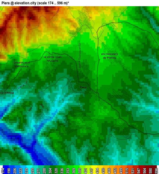
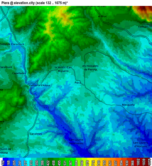
Below is the Elevation map of Piera, which displays elevation range with different colors. Scale of the first map is from 174 to 596 m (571 to 1955 ft) with average elevation of 333.2 meters (=1093 ft) [note 1]
These maps also provides idea of topography and contour of this city, they are displayed at different zoom levels. More info about maps, scale and edge coordinates you can find below images.
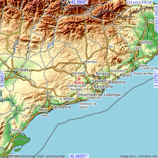
| \ | Map #1 | Map #2 | Topo.Map |
| Scale [m] | 174..596 m | 132..1075 m | × |
| Scale [ft] | 571..1955 ft | 433..3527 ft | × |
| Average | 333.2 m = 1093 ft | 347.8 m = 1141 ft | × |
| Width | 7.32 km = 4.5 mi | 14.63 km = 9.1 mi | 234.1 km = 145.5 mi |
| Height | 7.32 km = 4.5 mi | 14.63 km = 9.1 mi | 234.1 km = 145.5 mi |
| ↑Max Latitude | 41.555213° | 41.58809° | 42.5666° |
| Latitude at center | 41.52232° | 41.52232° | 41.52232° |
| ↓Min Latitude | 41.48941° | 41.456483° | 40.46091° |
| ← Min Longitude | 1.706815° | 1.662869° | 0.34451° |
| Longitude center | 1.75076° | 1.75076° | 1.75076° |
| →Max Longitude | 1.794705° | 1.838651° | 3.15701° |
Nearby cities:
Cities around Piera sort by population:
• Esparreguera elevation 184 m
10.1 km,  80°
80°
• Vilanova del Camí 310 m
10.9 km,  300°
300°
• Sant Sadurní d'Anoia 170 m
11.1 km,  165°
165°
• Masquefa 257 m
5.5 km,  112°
112°
• Capellades 324 m
5.4 km,  279°
279°
• Collbató 389 m
8.3 km,  50°
50°
• Òdena 366 m
12 km,  315°
315°
• Sant Pere de Riudebitlles 264 m
9.1 km,  207°
207°
• La Pobla de Claramunt 270 m
7.1 km, 300°
• Castellolí 393 m
9.4 km,  333°
333°
• el Pla del Penedès 207 m
12.1 km,  193°
193°
• Sant Llorenç d'Hortons 169 m
9.3 km,  131°
131°
Multilingual:
 En español:
Piera elevación 313 m.
 En France:
Piera élévation 313 m.


Sources and notes:
- [note 1] Map square and city borders are not equal. Map elevation data is calculated only from area inside that square.
- [src 1] Elevation data from geonames database provided with same terms of usage.
- [src 2] The elevation map of Piera is generated using elevation data from NASA's 3 arcsec (90m) resolution SRTM data.
- [src 3] Base (background) map © OpenStreetMap contributors tiles are generated by Geofabrik and OpenTopoMap.
Copyright & License:
This Piera Elevation Map is licensed under CC BY-SA. You may reuse any part from this page, if you give a proper credit by linking to this URL:
 More info on terms of use page.