Iniéstola elevation
Iniéstola (Castille-La Mancha, Provincia de Guadalajara), Spain elevation is 1166 meters and Iniéstola elevation in feet is 3825 ft above sea level [src 1]. Iniéstola is a seat of a third-order administrative division (feature code) with elevation that is 563 meters (1847 ft) bigger than average city elevation in Spain.
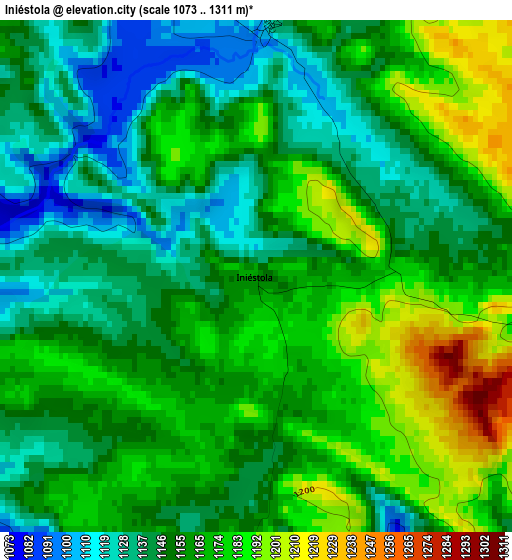
Below is the Elevation map of Iniéstola, which displays elevation range with different colors. Scale of the first map is from 1073 to 1311 m (3520 to 4301 ft) with average elevation of 1159.2 meters (=3803 ft) [note 1]
These maps also provides idea of topography and contour of this city, they are displayed at different zoom levels. More info about maps, scale and edge coordinates you can find below images.
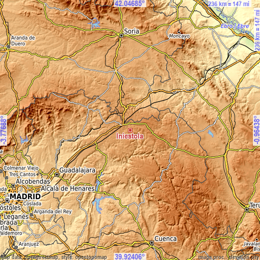
| \ | Map #1 | Topo.Map |
| Scale [m] | 1073..1311 m | × |
| Scale [ft] | 3520..4301 ft | × |
| Average | 1159.2 m = 3803 ft | × |
| Width | 7.38 km = 4.6 mi | 236 km = 146.6 mi |
| Height | 7.38 km = 4.6 mi | 236 km = 146.6 mi |
| ↑Max Latitude | 41.027161° | 42.04685° |
| Latitude at center | 40.994° | 40.994° |
| ↓Min Latitude | 40.960823° | 39.92406° |
| ← Min Longitude | -2.414575° | -3.77688° |
| Longitude center | -2.37063° | -2.37063° |
| →Max Longitude | -2.326685° | -0.96438° |
Nearby cities:
Cities around Iniéstola sort by population:
• Alcolea del Pinar elevation 1202 m
9.3 km,  299°
299°
• Anguita 1123 m
3.6 km,  2°
2°
• Maranchón 1251 m
15.1 km,  66°
66°
• Riba de Saelices 984 m
11.1 km,  146°
146°
• Abánades 1029 m
14.8 km,  220°
220°
• Luzaga 1076 m
6.6 km,  249°
249°
• Luzón 1185 m
8.7 km, 65°
• Saúca 1103 m
13.9 km,  287°
287°
• Saelices de la Sal 1001 m
10.4 km,  157°
157°
• Sotodosos 1152 m
8.3 km,  192°
192°
• Esplegares 1154 m
15.3 km,  180°
180°
• Estriégana 1107 m
14.7 km, 299°
Multilingual:
 En español:
Iniéstola elevación 1166 m.
 En France:
Iniéstola élévation 1166 m.
 Auf Deutsch:
Iniéstola höhe über dem Meeresspiegel ist 1166 m.

Sources and notes:
- [note 1] Map square and city borders are not equal. Map elevation data is calculated only from area inside that square.
- [src 1] Elevation data from geonames database provided with same terms of usage.
- [src 2] The elevation map of Iniéstola is generated using elevation data from NASA's 3 arcsec (90m) resolution SRTM data.
- [src 3] Base (background) map © OpenStreetMap contributors tiles are generated by Geofabrik and OpenTopoMap.
Copyright & License:
This Iniéstola Elevation Map is licensed under CC BY-SA. You may reuse any part from this page, if you give a proper credit by linking to this URL:
 More info on terms of use page.