Jaulín elevation
Jaulín (Aragon, Provincia de Zaragoza), Spain elevation is 513 meters and Jaulín elevation in feet is 1683 ft above sea level [src 1]. Jaulín is a seat of a third-order administrative division (feature code) with elevation that is 90 meters (295 ft) smaller than average city elevation in Spain.
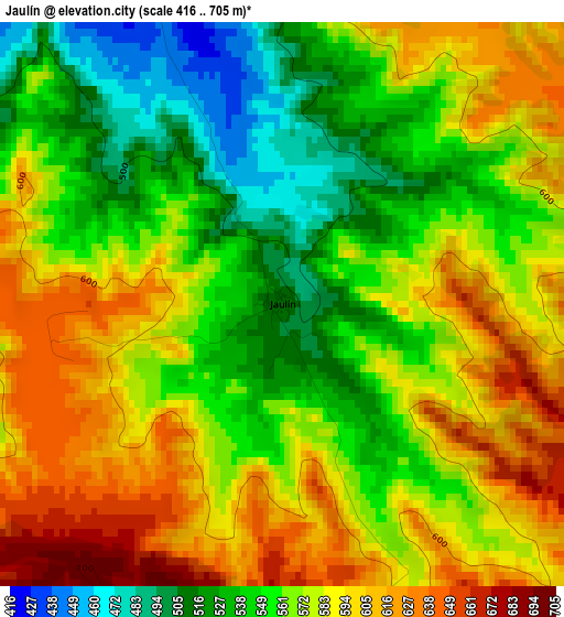
Below is the Elevation map of Jaulín, which displays elevation range with different colors. Scale of the first map is from 416 to 705 m (1365 to 2313 ft) with average elevation of 570.8 meters (=1873 ft) [note 1]
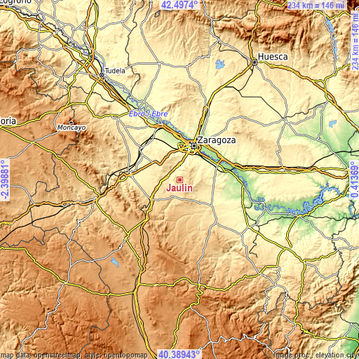
These maps also provides idea of topography and contour of this city, they are displayed at different zoom levels. More info about maps, scale and edge coordinates you can find below images.
| \ | Map #1 | Topo.Map |
| Scale [m] | 416..705 m | × |
| Scale [ft] | 1365..2313 ft | × |
| Average | 570.8 m = 1873 ft | × |
| Width | 7.32 km = 4.5 mi | 234.4 km = 145.6 mi |
| Height | 7.32 km = 4.5 mi | 234.4 km = 145.6 mi |
| ↑Max Latitude | 41.484909° | 42.4974° |
| Latitude at center | 41.45198° | 41.45198° |
| ↓Min Latitude | 41.419034° | 40.38943° |
| ← Min Longitude | -1.036505° | -2.39881° |
| Longitude center | -0.99256° | -0.99256° |
| →Max Longitude | -0.948615° | 0.41369° |
Nearby cities:
Cities around Jaulín sort by population:
• Cuarte de Huerva elevation 262 m
16.6 km,  17°
17°
• María de Huerva 339 m
9.7 km,  358°
358°
• Cadrete 304 m
11.8 km,  13°
13°
• Muel 429 m
7.9 km,  281°
281°
• Longares 536 m
15.7 km,  249°
249°
• Botorrita 393 m
6.9 km,  332°
332°
• Mezalocha 482 m
8.1 km, 248°
• Tosos 612 m
16.6 km,  203°
203°
• Fuendetodos 755 m
12.5 km,  167°
167°
• Puebla de Albortón 482 m
13.6 km,  123°
123°
• Mozota 397 m
7.2 km,  299°
299°
• Valmadrid 526 m
9 km,  95°
95°
Multilingual:
 En español:
Jaulín elevación 513 m.
 En France:
Jaulín élévation 513 m.


Sources and notes:
- [note 1] Map square and city borders are not equal. Map elevation data is calculated only from area inside that square.
- [src 1] Elevation data from geonames database provided with same terms of usage.
- [src 2] The elevation map of Jaulín is generated using elevation data from NASA's 3 arcsec (90m) resolution SRTM data.
- [src 3] Base (background) map © OpenStreetMap contributors tiles are generated by Geofabrik and OpenTopoMap.
Copyright & License:
This Jaulín Elevation Map is licensed under CC BY-SA. You may reuse any part from this page, if you give a proper credit by linking to this URL:
 More info on terms of use page.