Languilla elevation
Languilla (Castille and León, Provincia de Segovia), Spain elevation is 952 meters and Languilla elevation in feet is 3123 ft above sea level [src 1]. Languilla is a seat of a third-order administrative division (feature code) with elevation that is 349 meters (1145 ft) bigger than average city elevation in Spain.
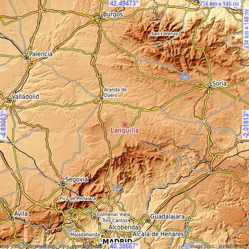
Below is the Elevation map of Languilla, which displays elevation range with different colors. Scale of the first map is from 923 to 1062 m (3028 to 3484 ft) with average elevation of 993.4 meters (=3259 ft) [note 1]
These maps also provides idea of topography and contour of this city, they are displayed at different zoom levels. More info about maps, scale and edge coordinates you can find below images.

| \ | Map #1 | Topo.Map |
| Scale [m] | 923..1062 m | × |
| Scale [ft] | 3028..3484 ft | × |
| Average | 993.4 m = 3259 ft | × |
| Width | 7.32 km = 4.5 mi | 234.4 km = 145.6 mi |
| Height | 7.32 km = 4.5 mi | 234.4 km = 145.6 mi |
| ↑Max Latitude | 41.482191° | 42.49473° |
| Latitude at center | 41.44926° | 41.44926° |
| ↓Min Latitude | 41.416313° | 40.38667° |
| ← Min Longitude | -3.468325° | -4.83063° |
| Longitude center | -3.42438° | -3.42438° |
| →Max Longitude | -3.380435° | -2.01813° |
Nearby cities:
Cities around Languilla sort by population:
• Ayllón elevation 986 m
5.3 km,  129°
129°
• Campo de San Pedro 971 m
10.4 km,  258°
258°
• Fresno de Cantespino 1036 m
11 km,  214°
214°
• Maderuelo 958 m
9.1 km,  296°
296°
• Corral de Ayllón 1028 m
7.1 km,  203°
203°
• Aldealengua de Santa María 946 m
3.8 km,  291°
291°
• Riaguas de San Bartolomé 934 m
6 km,  244°
244°
• Miño de San Esteban 941 m
11.6 km,  34°
34°
• Alconada de Maderuelo 946 m
5.1 km,  271°
271°
• Fuentecambrón 1015 m
10.1 km,  51°
51°
• Ribota 1032 m
9.4 km,  182°
182°
• Cilleruelo de San Mamés 986 m
12 km, 260°
Multilingual:
 En español:
Languilla elevación 952 m.
 En France:
Languilla élévation 952 m.
 Auf Deutsch:
Languilla höhe über dem Meeresspiegel ist 952 m.

Sources and notes:
- [note 1] Map square and city borders are not equal. Map elevation data is calculated only from area inside that square.
- [src 1] Elevation data from geonames database provided with same terms of usage.
- [src 2] The elevation map of Languilla is generated using elevation data from NASA's 3 arcsec (90m) resolution SRTM data.
- [src 3] Base (background) map © OpenStreetMap contributors tiles are generated by Geofabrik and OpenTopoMap.
Copyright & License:
This Languilla Elevation Map is licensed under CC BY-SA. You may reuse any part from this page, if you give a proper credit by linking to this URL:
 More info on terms of use page.