Lezáun elevation
Lezáun (Navarre, Provincia de Navarra), Spain elevation is 819 meters and Lezáun elevation in feet is 2687 ft above sea level [src 1]. Lezáun is a seat of a third-order administrative division (feature code) with elevation that is 216 meters (709 ft) bigger than average city elevation in Spain.
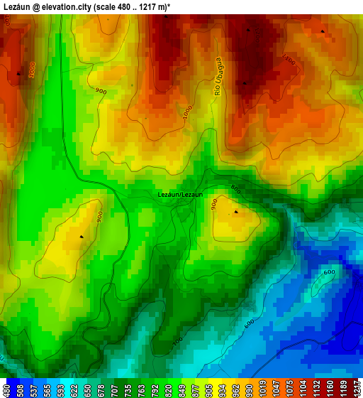
Below is the Elevation map of Lezáun, which displays elevation range with different colors. Scale of the first map is from 480 to 1217 m (1575 to 3993 ft) with average elevation of 855.4 meters (=2806 ft) [note 1]
These maps also provides idea of topography and contour of this city, they are displayed at different zoom levels. More info about maps, scale and edge coordinates you can find below images.
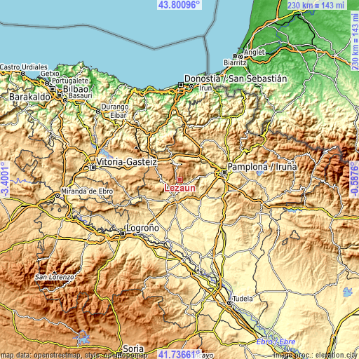
| \ | Map #1 | Topo.Map |
| Scale [m] | 480..1217 m | × |
| Scale [ft] | 1575..3993 ft | × |
| Average | 855.4 m = 2806 ft | × |
| Width | 7.17 km = 4.5 mi | 229.5 km = 142.6 mi |
| Height | 7.17 km = 4.5 mi | 229.5 km = 142.6 mi |
| ↑Max Latitude | 42.809637° | 43.80096° |
| Latitude at center | 42.77739° | 42.77739° |
| ↓Min Latitude | 42.745126° | 41.73661° |
| ← Min Longitude | -2.037795° | -3.4001° |
| Longitude center | -1.99385° | -1.99385° |
| →Max Longitude | -1.949905° | -0.5876° |
Nearby cities:
Cities around Lezáun sort by population:
• Estella-Lizarra elevation 430 m
12.2 km,  194°
194°
• Yerri 454 m
9.6 km,  151°
151°
• Ayegui 493 m
13.9 km,  195°
195°
• Villatuerta 428 m
13 km,  179°
179°
• Cirauqui 491 m
14.1 km,  143°
143°
• Goñi 879 m
11.1 km,  41°
41°
• Belascoáin 420 m
13.4 km,  100°
100°
• Salinas de Oro 683 m
8.5 km,  91°
91°
• Guirguillano 616 m
11.6 km,  125°
125°
• Ciriza 467 m
13.6 km,  83°
83°
• Bakaiku 519 m
15.6 km,  325°
325°
• Echarri 394 m
13.8 km, 88°
Multilingual:
 En español:
Lezáun elevación 819 m.
 En France:
Lezáun élévation 819 m.


Sources and notes:
- [note 1] Map square and city borders are not equal. Map elevation data is calculated only from area inside that square.
- [src 1] Elevation data from geonames database provided with same terms of usage.
- [src 2] The elevation map of Lezáun is generated using elevation data from NASA's 3 arcsec (90m) resolution SRTM data.
- [src 3] Base (background) map © OpenStreetMap contributors tiles are generated by Geofabrik and OpenTopoMap.
Copyright & License:
This Lezáun Elevation Map is licensed under CC BY-SA. You may reuse any part from this page, if you give a proper credit by linking to this URL:
 More info on terms of use page.