Lledó elevation
Lledó (Aragon, Provincia de Teruel), Spain elevation is 460 meters and Lledó elevation in feet is 1509 ft above sea level [src 1]. Lledó is a seat of a third-order administrative division (feature code) with elevation that is 143 meters (469 ft) smaller than average city elevation in Spain.
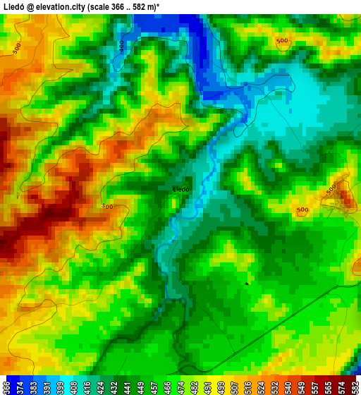
Below is the Elevation map of Lledó, which displays elevation range with different colors. Scale of the first map is from 366 to 582 m (1201 to 1909 ft) with average elevation of 465.5 meters (=1527 ft) [note 1]
These maps also provides idea of topography and contour of this city, they are displayed at different zoom levels. More info about maps, scale and edge coordinates you can find below images.
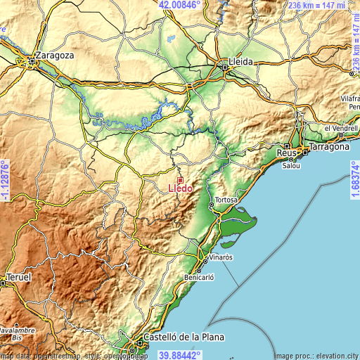
| \ | Map #1 | Topo.Map |
| Scale [m] | 366..582 m | × |
| Scale [ft] | 1201..1909 ft | × |
| Average | 465.5 m = 1527 ft | × |
| Width | 7.38 km = 4.6 mi | 236.2 km = 146.8 mi |
| Height | 7.38 km = 4.6 mi | 236.2 km = 146.8 mi |
| ↑Max Latitude | 40.98816° | 42.00846° |
| Latitude at center | 40.95498° | 40.95498° |
| ↓Min Latitude | 40.921783° | 39.88442° |
| ← Min Longitude | 0.233545° | -1.12876° |
| Longitude center | 0.27749° | 0.27749° |
| →Max Longitude | 0.321435° | 1.68374° |
Nearby cities:
Cities around Lledó sort by population:
• Gandesa elevation 374 m
17.4 km,  50°
50°
• Batea 365 m
15.7 km,  10°
10°
• Valderrobres 498 m
13.9 km,  228°
228°
• Calaceite 512 m
10.1 km,  312°
312°
• Benifallet 23 m
20.3 km,  83°
83°
• Bot 294 m
10.8 km,  56°
56°
• Mazaleón 363 m
18.1 km, 305°
• Valdeltormo 448 m
16.7 km,  282°
282°
• Arenys de Lledó / Arens de Lledó 378 m
4.2 km,  352°
352°
• Torre del Compte 505 m
14.3 km,  261°
261°
• Caseres 344 m
9 km, 345°
• Horta de Sant Joan 475 m
3.3 km,  99°
99°
Multilingual:
 En español:
Lledó elevación 460 m.
 En France:
Lledó élévation 460 m.


Sources and notes:
- [note 1] Map square and city borders are not equal. Map elevation data is calculated only from area inside that square.
- [src 1] Elevation data from geonames database provided with same terms of usage.
- [src 2] The elevation map of Lledó is generated using elevation data from NASA's 3 arcsec (90m) resolution SRTM data.
- [src 3] Base (background) map © OpenStreetMap contributors tiles are generated by Geofabrik and OpenTopoMap.
Copyright & License:
This Lledó Elevation Map is licensed under CC BY-SA. You may reuse any part from this page, if you give a proper credit by linking to this URL:
 More info on terms of use page.