Lousame elevation
Lousame (Galicia, Provincia da Coruña), Spain elevation is 147 meters and Lousame elevation in feet is 482 ft above sea level [src 1]. Lousame is a populated place (feature code) with elevation that is 456 meters (1496 ft) smaller than average city elevation in Spain.
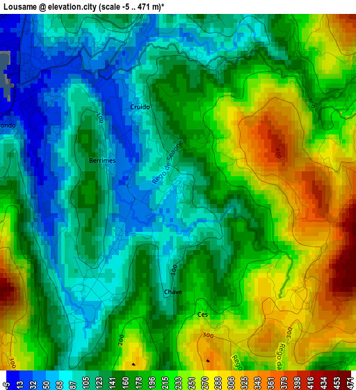
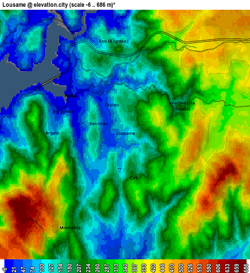
Below is the Elevation map of Lousame, which displays elevation range with different colors. Scale of the first map is from -5 to 471 m (-16 to 1545 ft) with average elevation of 173.3 meters (=569 ft) [note 1]
These maps also provides idea of topography and contour of this city, they are displayed at different zoom levels. More info about maps, scale and edge coordinates you can find below images.
| \ | Map #1 | Map #2 | Topo.Map |
| Scale [m] | -5..471 m | -6..686 m | × |
| Scale [ft] | -16..1545 ft | -20..2251 ft | × |
| Average | 173.3 m = 569 ft | 251 m = 823 ft | × |
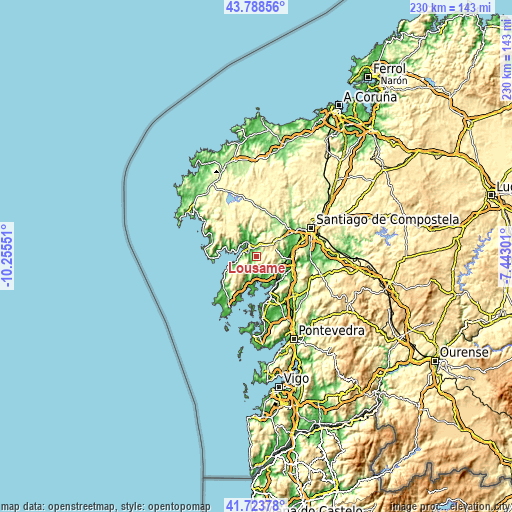
| Width | 7.17 km = 4.5 mi | 14.35 km = 8.9 mi | 229.6 km = 142.7 mi |
| Height | 7.17 km = 4.5 mi | 14.35 km = 8.9 mi | 229.6 km = 142.7 mi |
| ↑Max Latitude | 42.797024° | 42.829261° | 43.78856° |
| Latitude at center | 42.76477° | 42.76477° | 42.76477° |
| ↓Min Latitude | 42.732499° | 42.700212° | 41.72378° |
| ← Min Longitude | -8.893205° | -8.937151° | -10.25551° |
| Longitude center | -8.84926° | -8.84926° | -8.84926° |
| →Max Longitude | -8.805315° | -8.761369° | -7.44301° |
Nearby cities:
Cities around Lousame sort by population:
• Boiro elevation 29 m
13.4 km,  192°
192°
• Rianxo 23 m
13 km,  168°
168°
• Muros 14 m
17.3 km,  274°
274°
• Porto do Son 12 m
13.5 km,  250°
250°
• A Pobra do Caramiñal 8 m
19.4 km,  202°
202°
• Padrón 13 m
15.7 km,  100°
100°
• Outes 57 m
11.6 km,  338°
338°
• Negreira 178 m
17.8 km,  29°
29°
• Valga 75 m
18.7 km,  113°
113°
• Catoira 16 m
14.9 km,  136°
136°
• Rois 87 m
11.8 km,  90°
90°
• Noia 20 m
3.9 km,  306°
306°
Multilingual:
 En español:
Lousame elevación 147 m.
 En France:
Lousame élévation 147 m.


Sources and notes:
- [note 1] Map square and city borders are not equal. Map elevation data is calculated only from area inside that square.
- [src 1] Elevation data from geonames database provided with same terms of usage.
- [src 2] The elevation map of Lousame is generated using elevation data from NASA's 3 arcsec (90m) resolution SRTM data.
- [src 3] Base (background) map © OpenStreetMap contributors tiles are generated by Geofabrik and OpenTopoMap.
Copyright & License:
This Lousame Elevation Map is licensed under CC BY-SA. You may reuse any part from this page, if you give a proper credit by linking to this URL:
 More info on terms of use page.