Mecerreyes elevation
Mecerreyes (Castille and León, Provincia de Burgos), Spain elevation is 986 meters and Mecerreyes elevation in feet is 3235 ft above sea level [src 1]. Mecerreyes is a seat of a third-order administrative division (feature code) with elevation that is 383 meters (1257 ft) bigger than average city elevation in Spain.
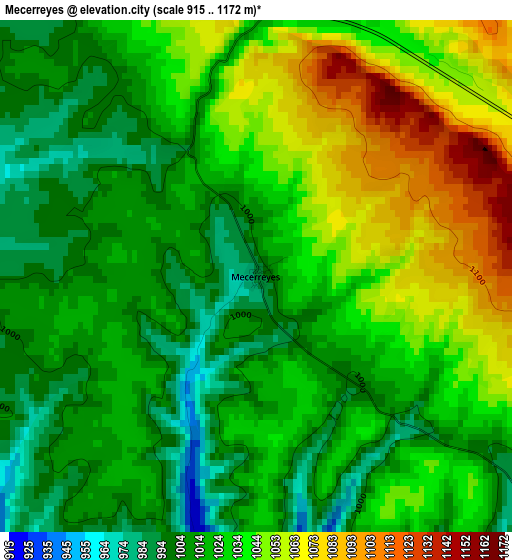
Below is the Elevation map of Mecerreyes, which displays elevation range with different colors. Scale of the first map is from 915 to 1172 m (3002 to 3845 ft) with average elevation of 1027.9 meters (=3372 ft) [note 1]
These maps also provides idea of topography and contour of this city, they are displayed at different zoom levels. More info about maps, scale and edge coordinates you can find below images.
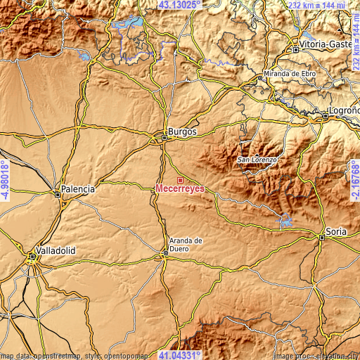
| \ | Map #1 | Topo.Map |
| Scale [m] | 915..1172 m | × |
| Scale [ft] | 3002..3845 ft | × |
| Average | 1027.9 m = 3372 ft | × |
| Width | 7.25 km = 4.5 mi | 232 km = 144.2 mi |
| Height | 7.25 km = 4.5 mi | 232 km = 144.2 mi |
| ↑Max Latitude | 42.12796° | 43.13025° |
| Latitude at center | 42.09536° | 42.09536° |
| ↓Min Latitude | 42.062743° | 41.04331° |
| ← Min Longitude | -3.617875° | -4.98018° |
| Longitude center | -3.57393° | -3.57393° |
| →Max Longitude | -3.529985° | -2.16768° |
Nearby cities:
Cities around Mecerreyes sort by population:
• Covarrubias elevation 892 m
6 km,  131°
131°
• Madrigal del Monte 939 m
10 km,  303°
303°
• Santa Inés 861 m
12.3 km,  240°
240°
• Hontoria de la Cantera 945 m
11.8 km,  331°
331°
• Puentedura 865 m
6 km,  186°
186°
• Campolara 973 m
12.4 km,  77°
77°
• Torrecilla del Monte 945 m
9.9 km,  269°
269°
• Cubillo del Campo 993 m
8.7 km,  339°
339°
• Mambrillas de Lara 992 m
9.2 km,  90°
90°
• Retuerta 905 m
9.2 km,  142°
142°
• Cuevas de San Clemente 1033 m
3.9 km,  6°
6°
• Torrelara 998 m
9.2 km,  30°
30°
Multilingual:
 En español:
Mecerreyes elevación 986 m.
 En France:
Mecerreyes élévation 986 m.
 Auf Deutsch:
Mecerreyes höhe über dem Meeresspiegel ist 986 m.

Sources and notes:
- [note 1] Map square and city borders are not equal. Map elevation data is calculated only from area inside that square.
- [src 1] Elevation data from geonames database provided with same terms of usage.
- [src 2] The elevation map of Mecerreyes is generated using elevation data from NASA's 3 arcsec (90m) resolution SRTM data.
- [src 3] Base (background) map © OpenStreetMap contributors tiles are generated by Geofabrik and OpenTopoMap.
Copyright & License:
This Mecerreyes Elevation Map is licensed under CC BY-SA. You may reuse any part from this page, if you give a proper credit by linking to this URL:
 More info on terms of use page.