Monistrol de Montserrat elevation
Monistrol de Montserrat (Catalonia, Província de Barcelona), Spain elevation is 153 meters and Monistrol de Montserrat elevation in feet is 502 ft above sea level [src 1]. Monistrol de Montserrat is a populated place (feature code) with elevation that is 450 meters (1476 ft) smaller than average city elevation in Spain.
Below is the Elevation map of Monistrol de Montserrat, which displays elevation range with different colors. Scale of the first map is from 111 to 1204 m (364 to 3950 ft) with average elevation of 377.2 meters (=1238 ft) [note 1]
These maps also provides idea of topography and contour of this city, they are displayed at different zoom levels. More info about maps, scale and edge coordinates you can find below images.
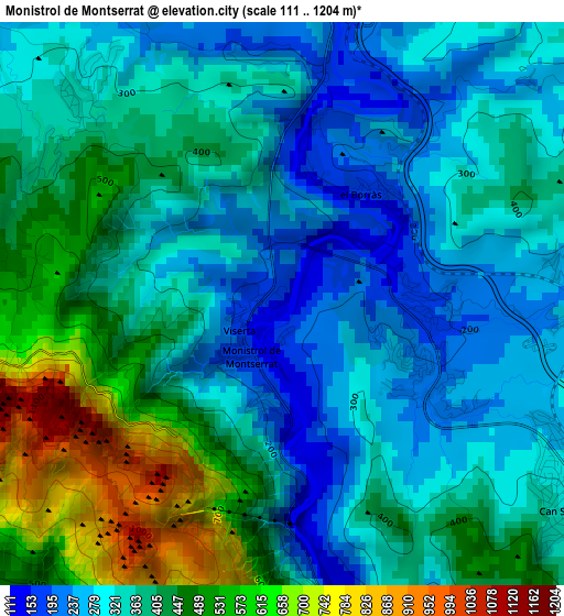
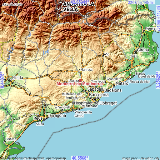
| \ | Map #1 | Topo.Map |
| Scale [m] | 111..1204 m | × |
| Scale [ft] | 364..3950 ft | × |
| Average | 377.2 m = 1238 ft | × |
| Width | 7.31 km = 4.5 mi | 233.8 km = 145.3 mi |
| Height | 7.31 km = 4.5 mi | 233.8 km = 145.3 mi |
| ↑Max Latitude | 41.649515° | 42.65941° |
| Latitude at center | 41.61667° | 41.61667° |
| ↓Min Latitude | 41.583808° | 40.5568° |
| ← Min Longitude | 1.806055° | 0.44375° |
| Longitude center | 1.85° | 1.85° |
| →Max Longitude | 1.893945° | 3.25625° |
Nearby cities:
Cities around Monistrol de Montserrat sort by population:
• Manresa elevation 241 m
12.6 km,  350°
350°
• Olesa de Montserrat 116 m
8.9 km,  155°
155°
• Esparreguera 184 m
8.9 km,  169°
169°
• Piera 313 m
13.3 km,  218°
218°
• Abrera 111 m
11.9 km, 159°
• Sant Vicenç de Castellet 198 m
5.7 km,  13°
13°
• Masquefa 257 m
13 km,  194°
194°
• Collbató 389 m
5.5 km,  200°
200°
• Sant Salvador de Guardiola 316 m
10.1 km,  316°
316°
• Ullastrell 317 m
13.3 km,  138°
138°
• Castellolí 393 m
12.6 km,  260°
260°
• Viladecavalls 298 m
11.1 km,  131°
131°
Multilingual:
 En español:
Monistrol de Montserrat elevación 153 m.
 En France:
Monistrol de Montserrat élévation 153 m.
 Auf Deutsch:
Monistrol de Montserrat höhe über dem Meeresspiegel ist 153 m.
 На русском:
Монистроль-де-Монсеррат высота над уровнем моря 153 м
Sources and notes:
- [note 1] Map square and city borders are not equal. Map elevation data is calculated only from area inside that square.
- [src 1] Elevation data from geonames database provided with same terms of usage.
- [src 2] The elevation map of Monistrol de Montserrat is generated using elevation data from NASA's 3 arcsec (90m) resolution SRTM data.
- [src 3] Base (background) map © OpenStreetMap contributors tiles are generated by Geofabrik and OpenTopoMap.
Copyright & License:
This Monistrol de Montserrat Elevation Map is licensed under CC BY-SA. You may reuse any part from this page, if you give a proper credit by linking to this URL:
 More info on terms of use page.