Navia elevation
Navia (Asturias, Province of Asturias), Spain elevation is 38 meters and Navia elevation in feet is 125 ft above sea level [src 1]. Navia is a seat of a third-order administrative division (feature code) with elevation that is 565 meters (1854 ft) smaller than average city elevation in Spain.
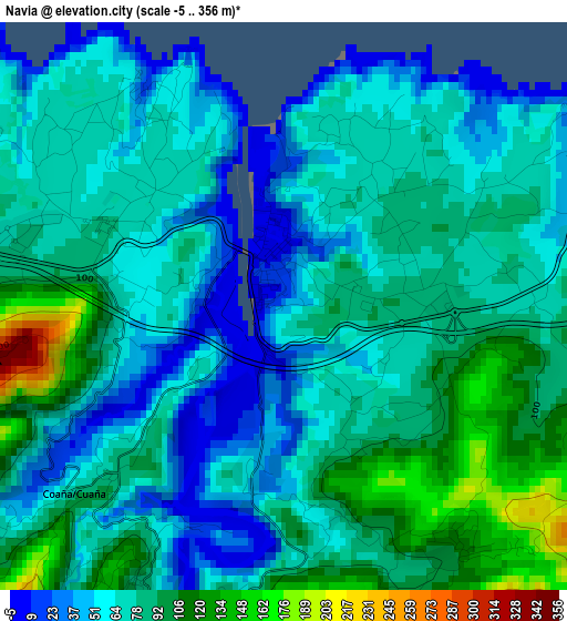
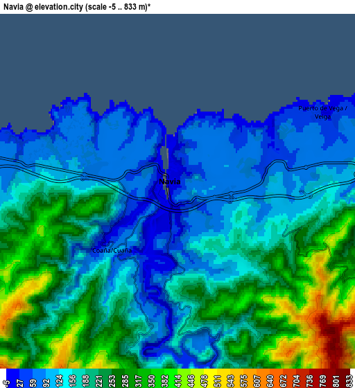
Below is the Elevation map of Navia, which displays elevation range with different colors. Scale of the first map is from -5 to 356 m (-16 to 1168 ft) with average elevation of 75.6 meters (=248 ft) [note 1]
These maps also provides idea of topography and contour of this city, they are displayed at different zoom levels. More info about maps, scale and edge coordinates you can find below images.
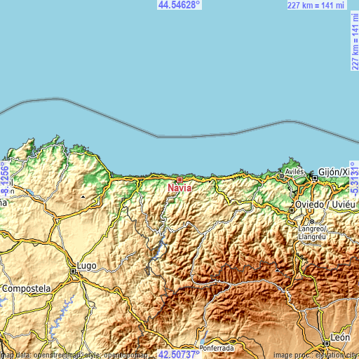
| \ | Map #1 | Map #2 | Topo.Map |
| Scale [m] | -5..356 m | -5..833 m | × |
| Scale [ft] | -16..1168 ft | -16..2733 ft | × |
| Average | 75.6 m = 248 ft | 190.6 m = 625 ft | × |
| Width | 7.08 km = 4.4 mi | 14.17 km = 8.8 mi | 226.7 km = 140.9 mi |
| Height | 7.08 km = 4.4 mi | 14.17 km = 8.8 mi | 226.7 km = 140.9 mi |
| ↑Max Latitude | 43.56729° | 43.599123° | 44.54628° |
| Latitude at center | 43.53544° | 43.53544° | 43.53544° |
| ↓Min Latitude | 43.503573° | 43.47169° | 42.50737° |
| ← Min Longitude | -6.763295° | -6.807241° | -8.1256° |
| Longitude center | -6.71935° | -6.71935° | -6.71935° |
| →Max Longitude | -6.675405° | -6.631459° | -5.3131° |
Nearby cities:
Cities around Navia sort by population:
• Tineo elevation 704 m
33 km,  131°
131°
• Ribadeo 45 m
25.9 km,  270°
270°
• Vegadeo 9 m
28 km,  254°
254°
• Tapia de Casariego 24 m
18.5 km,  282°
282°
• El Franco 54 m
12 km, 280°
• Coaña 71 m
3.8 km,  230°
230°
• Pola de Allande 556 m
30.2 km,  164°
164°
• Boal 412 m
13.9 km,  213°
213°
• Vilaión 372 m
9.7 km,  173°
173°
• Illano 419 m
25.3 km, 207°
• Villanueva de Oscos 646 m
32.9 km,  220°
220°
• Castropol 27 m
25.1 km, 268°
Multilingual:
 En español:
Navia elevación 38 m.
 En France:
Navia élévation 38 m.


Sources and notes:
- [note 1] Map square and city borders are not equal. Map elevation data is calculated only from area inside that square.
- [src 1] Elevation data from geonames database provided with same terms of usage.
- [src 2] The elevation map of Navia is generated using elevation data from NASA's 3 arcsec (90m) resolution SRTM data.
- [src 3] Base (background) map © OpenStreetMap contributors tiles are generated by Geofabrik and OpenTopoMap.
Copyright & License:
This Navia Elevation Map is licensed under CC BY-SA. You may reuse any part from this page, if you give a proper credit by linking to this URL:
 More info on terms of use page.