Olvega elevation
Olvega (Castille and León, Provincia de Soria), Spain elevation is 1040 meters and Olvega elevation in feet is 3412 ft above sea level [src 1]. Olvega is a populated place (feature code) with elevation that is 437 meters (1434 ft) bigger than average city elevation in Spain.
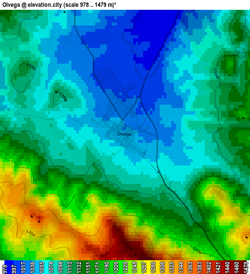
Below is the Elevation map of Olvega, which displays elevation range with different colors. Scale of the first map is from 978 to 1479 m (3209 to 4852 ft) with average elevation of 1125.6 meters (=3693 ft) [note 1]
These maps also provides idea of topography and contour of this city, they are displayed at different zoom levels. More info about maps, scale and edge coordinates you can find below images.
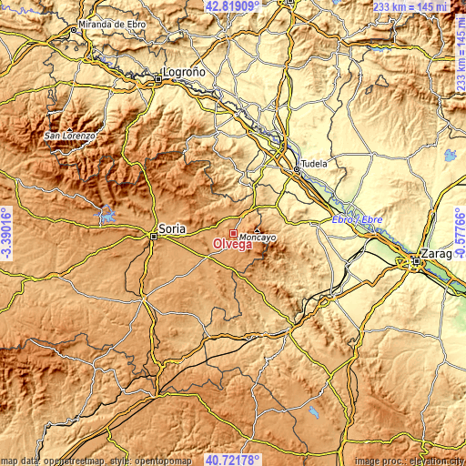
| \ | Map #1 | Topo.Map |
| Scale [m] | 978..1479 m | × |
| Scale [ft] | 3209..4852 ft | × |
| Average | 1125.6 m = 3693 ft | × |
| Width | 7.29 km = 4.5 mi | 233.2 km = 144.9 mi |
| Height | 7.29 km = 4.5 mi | 233.2 km = 144.9 mi |
| ↑Max Latitude | 41.811773° | 42.81909° |
| Latitude at center | 41.77901° | 41.77901° |
| ↓Min Latitude | 41.746231° | 40.72178° |
| ← Min Longitude | -2.027855° | -3.39016° |
| Longitude center | -1.98391° | -1.98391° |
| →Max Longitude | -1.939965° | -0.57766° |
Nearby cities:
Cities around Olvega sort by population:
• Ágreda elevation 958 m
9.9 km,  30°
30°
• Castilruiz 1012 m
12.5 km,  330°
330°
• Noviercas 1096 m
8.6 km,  209°
209°
• Matalebreras 996 m
8.6 km,  323°
323°
• Cueva de Ágreda 1298 m
8.1 km,  102°
102°
• Pozalmuro 1051 m
9.8 km,  267°
267°
• Fuentestrún 1012 m
13.4 km, 322°
• Vozmediano 902 m
12.5 km,  58°
58°
• Hinojosa del Campo 1036 m
10.6 km,  244°
244°
• Tajahuerce 1057 m
14.5 km,  252°
252°
• Villar del Campo 1036 m
13.8 km, 274°
• Pinilla del Campo 1047 m
10.8 km,  230°
230°
Multilingual:
 En español:
Olvega elevación 1040 m.
 En France:
Olvega élévation 1040 m.


Sources and notes:
- [note 1] Map square and city borders are not equal. Map elevation data is calculated only from area inside that square.
- [src 1] Elevation data from geonames database provided with same terms of usage.
- [src 2] The elevation map of Olvega is generated using elevation data from NASA's 3 arcsec (90m) resolution SRTM data.
- [src 3] Base (background) map © OpenStreetMap contributors tiles are generated by Geofabrik and OpenTopoMap.
Copyright & License:
This Olvega Elevation Map is licensed under CC BY-SA. You may reuse any part from this page, if you give a proper credit by linking to this URL:
 More info on terms of use page.