Padrenda elevation
Padrenda (Galicia, Provincia de Ourense), Spain elevation is 273 meters and Padrenda elevation in feet is 896 ft above sea level [src 1]. Padrenda is a seat of a third-order administrative division (feature code) with elevation that is 330 meters (1083 ft) smaller than average city elevation in Spain.
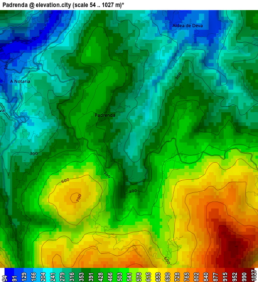
Below is the Elevation map of Padrenda, which displays elevation range with different colors. Scale of the first map is from 54 to 1027 m (177 to 3369 ft) with average elevation of 430.5 meters (=1412 ft) [note 1]
These maps also provides idea of topography and contour of this city, they are displayed at different zoom levels. More info about maps, scale and edge coordinates you can find below images.
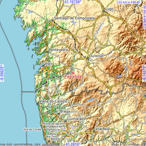
| \ | Map #1 | Topo.Map |
| Scale [m] | 54..1027 m | × |
| Scale [ft] | 177..3369 ft | × |
| Average | 430.5 m = 1412 ft | × |
| Width | 7.25 km = 4.5 mi | 231.9 km = 144.1 mi |
| Height | 7.25 km = 4.5 mi | 231.9 km = 144.1 mi |
| ↑Max Latitude | 42.165911° | 43.16759° |
| Latitude at center | 42.13333° | 42.13333° |
| ↓Min Latitude | 42.100732° | 41.0819° |
| ← Min Longitude | -8.193945° | -9.55625° |
| Longitude center | -8.15° | -8.15° |
| →Max Longitude | -8.106055° | -6.74375° |
Nearby cities:
Cities around Padrenda sort by population:
• Celanova elevation 515 m
16.2 km,  82°
82°
• Ribadavia 96 m
17.2 km,  1°
1°
• Arbo 187 m
13.9 km,  262°
262°
• Covelo 553 m
19.9 km,  304°
304°
• Cartelle 362 m
14.6 km,  26°
26°
• Bande 728 m
18.4 km,  128°
128°
• Castrelo de Miño 218 m
19.5 km,  20°
20°
• Carballeda de Avia 261 m
20.9 km,  356°
356°
• Melón 470 m
15.1 km,  339°
339°
• Verea 806 m
12.7 km,  103°
103°
• Quintela de Leirado 376 m
4.1 km, 80°
• Cortegada 141 m
8.6 km,  350°
350°
Multilingual:
 En español:
Padrenda elevación 273 m.
 En France:
Padrenda élévation 273 m.
 Auf Deutsch:
Padrenda höhe über dem Meeresspiegel ist 273 m.

Sources and notes:
- [note 1] Map square and city borders are not equal. Map elevation data is calculated only from area inside that square.
- [src 1] Elevation data from geonames database provided with same terms of usage.
- [src 2] The elevation map of Padrenda is generated using elevation data from NASA's 3 arcsec (90m) resolution SRTM data.
- [src 3] Base (background) map © OpenStreetMap contributors tiles are generated by Geofabrik and OpenTopoMap.
Copyright & License:
This Padrenda Elevation Map is licensed under CC BY-SA. You may reuse any part from this page, if you give a proper credit by linking to this URL:
 More info on terms of use page.