Portillo elevation
Portillo (Castille and León, Provincia de Valladolid), Spain elevation is 850 meters and Portillo elevation in feet is 2789 ft above sea level [src 1]. Portillo is a seat of a third-order administrative division (feature code) with elevation that is 247 meters (810 ft) bigger than average city elevation in Spain.
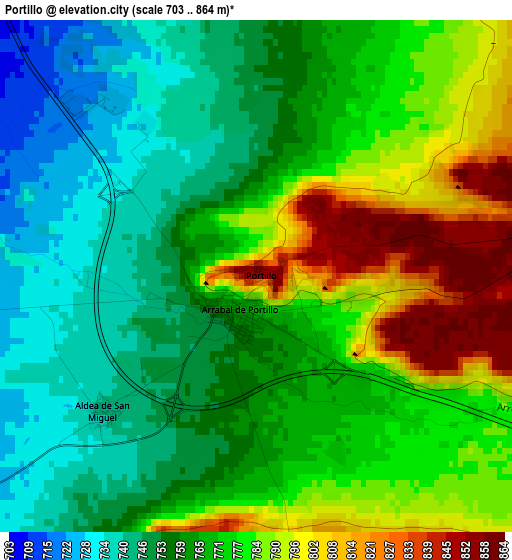
Below is the Elevation map of Portillo, which displays elevation range with different colors. Scale of the first map is from 703 to 864 m (2306 to 2835 ft) with average elevation of 769.4 meters (=2524 ft) [note 1]
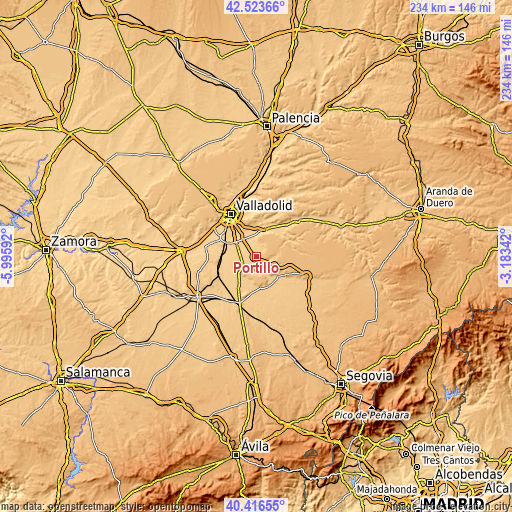
These maps also provides idea of topography and contour of this city, they are displayed at different zoom levels. More info about maps, scale and edge coordinates you can find below images.
| \ | Map #1 | Topo.Map |
| Scale [m] | 703..864 m | × |
| Scale [ft] | 2306..2835 ft | × |
| Average | 769.4 m = 2524 ft | × |
| Width | 7.32 km = 4.5 mi | 234.3 km = 145.6 mi |
| Height | 7.32 km = 4.5 mi | 234.3 km = 145.6 mi |
| ↑Max Latitude | 41.511586° | 42.52366° |
| Latitude at center | 41.47867° | 41.47867° |
| ↓Min Latitude | 41.445738° | 40.41655° |
| ← Min Longitude | -4.633615° | -5.99592° |
| Longitude center | -4.58967° | -4.58967° |
| →Max Longitude | -4.545725° | -3.18342° |
Nearby cities:
Cities around Portillo sort by population:
• Iscar elevation 755 m
13.9 km,  160°
160°
• Tudela de Duero 706 m
11.8 km,  3°
3°
• Mojados 718 m
8.1 km,  230°
230°
• Boecillo 726 m
11.5 km,  307°
307°
• Aldeamayor de San Martín 708 m
5.6 km, 312°
• La Pedraja de Portillo 719 m
4.8 km,  260°
260°
• Montemayor de Pililla 871 m
11.5 km,  73°
73°
• San Miguel del Arroyo 817 m
11.5 km,  109°
109°
• Megeces 735 m
8.2 km, 163°
• Mata de Cuéllar 753 m
13.4 km,  132°
132°
• Aldea de San Miguel 742 m
2.9 km, 227°
• Camporredondo 802 m
7.1 km,  94°
94°
Multilingual:
 En español:
Portillo elevación 850 m.
 En France:
Portillo élévation 850 m.
 Auf Deutsch:
Portillo höhe über dem Meeresspiegel ist 850 m.

Sources and notes:
- [note 1] Map square and city borders are not equal. Map elevation data is calculated only from area inside that square.
- [src 1] Elevation data from geonames database provided with same terms of usage.
- [src 2] The elevation map of Portillo is generated using elevation data from NASA's 3 arcsec (90m) resolution SRTM data.
- [src 3] Base (background) map © OpenStreetMap contributors tiles are generated by Geofabrik and OpenTopoMap.
Copyright & License:
This Portillo Elevation Map is licensed under CC BY-SA. You may reuse any part from this page, if you give a proper credit by linking to this URL:
 More info on terms of use page.