Reznos elevation
Reznos (Castille and León, Provincia de Soria), Spain elevation is 1048 meters and Reznos elevation in feet is 3438 ft above sea level [src 1]. Reznos is a seat of a third-order administrative division (feature code) with elevation that is 445 meters (1460 ft) bigger than average city elevation in Spain.
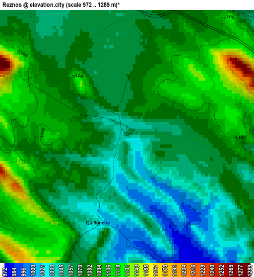
Below is the Elevation map of Reznos, which displays elevation range with different colors. Scale of the first map is from 972 to 1289 m (3189 to 4229 ft) with average elevation of 1073.9 meters (=3523 ft) [note 1]
These maps also provides idea of topography and contour of this city, they are displayed at different zoom levels. More info about maps, scale and edge coordinates you can find below images.
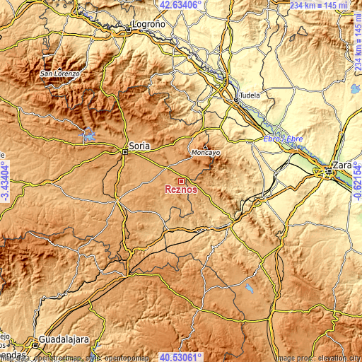
| \ | Map #1 | Topo.Map |
| Scale [m] | 972..1289 m | × |
| Scale [ft] | 3189..4229 ft | × |
| Average | 1073.9 m = 3523 ft | × |
| Width | 7.31 km = 4.5 mi | 233.9 km = 145.3 mi |
| Height | 7.31 km = 4.5 mi | 233.9 km = 145.3 mi |
| ↑Max Latitude | 41.623758° | 42.63406° |
| Latitude at center | 41.5909° | 41.5909° |
| ↓Min Latitude | 41.558025° | 40.53061° |
| ← Min Longitude | -2.071735° | -3.43404° |
| Longitude center | -2.02779° | -2.02779° |
| →Max Longitude | -1.983845° | -0.62154° |
Nearby cities:
Cities around Reznos sort by population:
• Borobia elevation 1137 m
13.7 km,  53°
53°
• Noviercas 1096 m
13.5 km,  357°
357°
• Almazul 987 m
10 km,  259°
259°
• Malanquilla 1050 m
13 km,  101°
101°
• Ciria 1028 m
6 km,  59°
59°
• Bijuesca 933 m
10.5 km,  121°
121°
• Torrubia de Soria 1044 m
6.9 km,  309°
309°
• Berdejo 985 m
7.7 km, 115°
• Torrelapaja 992 m
6.4 km, 99°
• Villaseca de Arciel 1007 m
11.7 km,  288°
288°
• Carabantes 987 m
5 km,  150°
150°
• Portillo de Soria 1025 m
9.2 km,  302°
302°
Multilingual:
 En español:
Reznos elevación 1048 m.
 En France:
Reznos élévation 1048 m.


Sources and notes:
- [note 1] Map square and city borders are not equal. Map elevation data is calculated only from area inside that square.
- [src 1] Elevation data from geonames database provided with same terms of usage.
- [src 2] The elevation map of Reznos is generated using elevation data from NASA's 3 arcsec (90m) resolution SRTM data.
- [src 3] Base (background) map © OpenStreetMap contributors tiles are generated by Geofabrik and OpenTopoMap.
Copyright & License:
This Reznos Elevation Map is licensed under CC BY-SA. You may reuse any part from this page, if you give a proper credit by linking to this URL:
 More info on terms of use page.