Riudoms elevation
Riudoms (Catalonia, Província de Tarragona), Spain elevation is 117 meters and Riudoms elevation in feet is 384 ft above sea level [src 1]. Riudoms is a seat of a third-order administrative division (feature code) with elevation that is 486 meters (1594 ft) smaller than average city elevation in Spain.
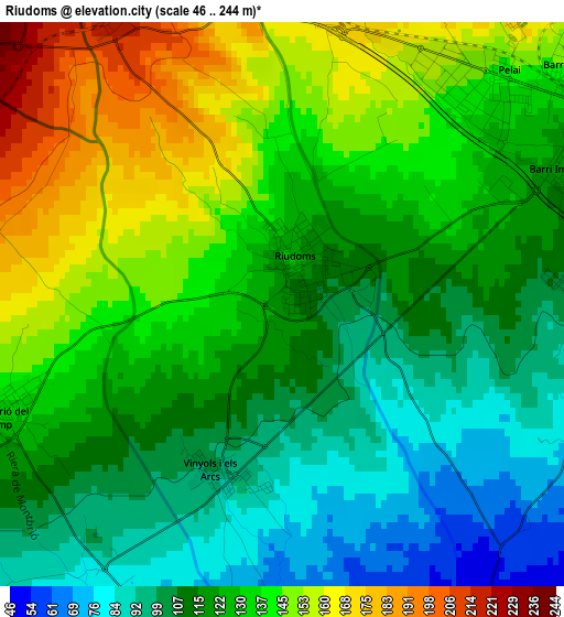
Below is the Elevation map of Riudoms, which displays elevation range with different colors. Scale of the first map is from 46 to 244 m (151 to 801 ft) with average elevation of 125.2 meters (=411 ft) [note 1]
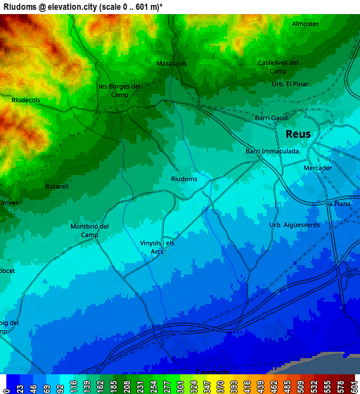
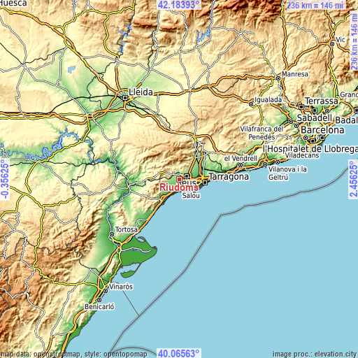
These maps also provides idea of topography and contour of this city, they are displayed at different zoom levels. More info about maps, scale and edge coordinates you can find below images.
| \ | Map #1 | Map #2 | Topo.Map |
| Scale [m] | 46..244 m | 0..601 m | × |
| Scale [ft] | 151..801 ft | 0..1972 ft | × |
| Average | 125.2 m = 411 ft | 147.8 m = 485 ft | × |
| Width | 7.36 km = 4.6 mi | 14.72 km = 9.1 mi | 235.5 km = 146.3 mi |
| Height | 7.36 km = 4.6 mi | 14.72 km = 9.1 mi | 235.5 km = 146.3 mi |
| ↑Max Latitude | 41.16642° | 41.199494° | 42.18393° |
| Latitude at center | 41.13333° | 41.13333° | 41.13333° |
| ↓Min Latitude | 41.100223° | 41.067099° | 40.06563° |
| ← Min Longitude | 1.006055° | 0.962109° | -0.35625° |
| Longitude center | 1.05° | 1.05° | 1.05° |
| →Max Longitude | 1.093945° | 1.137891° | 2.45625° |
Nearby cities:
Cities around Riudoms sort by population:
• Reus elevation 133 m
5.4 km,  61°
61°
• Cambrils 13 m
7.1 km,  173°
173°
• Salou 6 m
9.9 km,  129°
129°
• Vila-seca 40 m
8.5 km,  106°
106°
• Mont-roig del Camp 112 m
9.2 km,  235°
235°
• les Borges del Camp 217 m
4.6 km,  323°
323°
• Riudecols 318 m
7.3 km,  302°
302°
• Almoster 282 m
8.8 km,  35°
35°
• Botarell 198 m
5.1 km,  273°
273°
• Duesaigües 335 m
9.9 km,  280°
280°
• Vilanova d'Escornalbou 280 m
9.9 km,  259°
259°
• Riudecanyes 204 m
7 km, 270°
Multilingual:
 En español:
Ruidoms elevación 117 m.
 En France:
Riudoms élévation 117 m.


Sources and notes:
- [note 1] Map square and city borders are not equal. Map elevation data is calculated only from area inside that square.
- [src 1] Elevation data from geonames database provided with same terms of usage.
- [src 2] The elevation map of Riudoms is generated using elevation data from NASA's 3 arcsec (90m) resolution SRTM data.
- [src 3] Base (background) map © OpenStreetMap contributors tiles are generated by Geofabrik and OpenTopoMap.
Copyright & License:
This Riudoms Elevation Map is licensed under CC BY-SA. You may reuse any part from this page, if you give a proper credit by linking to this URL:
 More info on terms of use page.