Salillas elevation
Salillas (Aragon, Provincia de Huesca), Spain elevation is 428 meters and Salillas elevation in feet is 1404 ft above sea level [src 1]. Salillas is a seat of a third-order administrative division (feature code) with elevation that is 175 meters (574 ft) smaller than average city elevation in Spain.
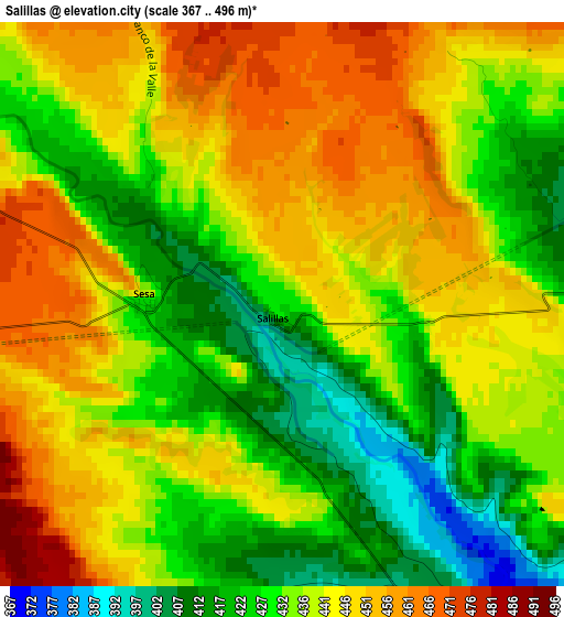
Below is the Elevation map of Salillas, which displays elevation range with different colors. Scale of the first map is from 367 to 496 m (1204 to 1627 ft) with average elevation of 437.6 meters (=1436 ft) [note 1]
These maps also provides idea of topography and contour of this city, they are displayed at different zoom levels. More info about maps, scale and edge coordinates you can find below images.
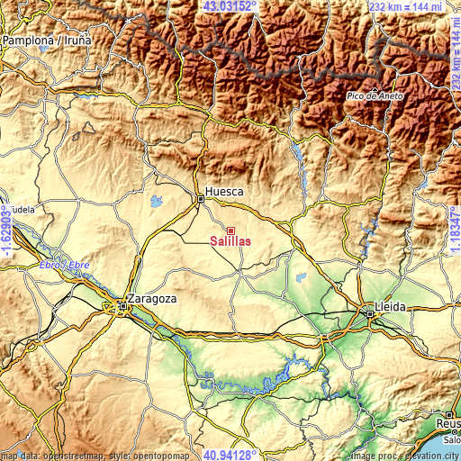
| \ | Map #1 | Topo.Map |
| Scale [m] | 367..496 m | × |
| Scale [ft] | 1204..1627 ft | × |
| Average | 437.6 m = 1436 ft | × |
| Width | 7.26 km = 4.5 mi | 232.4 km = 144.4 mi |
| Height | 7.26 km = 4.5 mi | 232.4 km = 144.4 mi |
| ↑Max Latitude | 42.027632° | 43.03152° |
| Latitude at center | 41.99498° | 41.99498° |
| ↓Min Latitude | 41.962311° | 40.94128° |
| ← Min Longitude | -0.266725° | -1.62903° |
| Longitude center | -0.22278° | -0.22278° |
| →Max Longitude | -0.178835° | 1.18347° |
Nearby cities:
Cities around Salillas sort by population:
• Alberuela de Tubo elevation 352 m
9.6 km,  175°
175°
• Alcalá del Obispo 499 m
10.8 km,  328°
328°
• Huerto 374 m
8.5 km,  146°
146°
• Sesa 430 m
1.8 km,  269°
269°
• Novales 457 m
6.7 km,  307°
307°
• Antillón 479 m
6.8 km,  47°
47°
• Pertusa 375 m
7.9 km,  84°
84°
• Argavieso 484 m
7.9 km,  324°
324°
• Torres de Alcanadre 391 m
9.7 km,  108°
108°
• Albero Alto 442 m
11.3 km,  303°
303°
• Tramaced 397 m
6.6 km,  248°
248°
• Piracés 423 m
7.9 km,  277°
277°
Multilingual:
 En español:
Salillas elevación 428 m.
 En France:
Salillas élévation 428 m.
 Auf Deutsch:
Salillas höhe über dem Meeresspiegel ist 428 m.

Sources and notes:
- [note 1] Map square and city borders are not equal. Map elevation data is calculated only from area inside that square.
- [src 1] Elevation data from geonames database provided with same terms of usage.
- [src 2] The elevation map of Salillas is generated using elevation data from NASA's 3 arcsec (90m) resolution SRTM data.
- [src 3] Base (background) map © OpenStreetMap contributors tiles are generated by Geofabrik and OpenTopoMap.
Copyright & License:
This Salillas Elevation Map is licensed under CC BY-SA. You may reuse any part from this page, if you give a proper credit by linking to this URL:
 More info on terms of use page.