Santas Martas elevation
Santas Martas (Castille and León, Provincia de León), Spain elevation is 838 meters and Santas Martas elevation in feet is 2749 ft above sea level [src 1]. Santas Martas is a seat of a third-order administrative division (feature code) with elevation that is 235 meters (771 ft) bigger than average city elevation in Spain.
Below is the Elevation map of Santas Martas, which displays elevation range with different colors. Scale of the first map is from 795 to 851 m (2608 to 2792 ft) with average elevation of 826 meters (=2710 ft) [note 1]
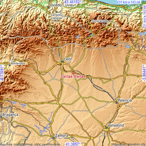
These maps also provides idea of topography and contour of this city, they are displayed at different zoom levels. More info about maps, scale and edge coordinates you can find below images.
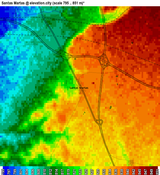
| \ | Map #1 | Topo.Map |
| Scale [m] | 795..851 m | × |
| Scale [ft] | 2608..2792 ft | × |
| Average | 826 m = 2710 ft | × |
| Width | 7.21 km = 4.5 mi | 230.8 km = 143.4 mi |
| Height | 7.21 km = 4.5 mi | 230.8 km = 143.4 mi |
| ↑Max Latitude | 42.464627° | 43.46152° |
| Latitude at center | 42.4322° | 42.4322° |
| ↓Min Latitude | 42.399757° | 41.3857° |
| ← Min Longitude | -5.414605° | -6.77691° |
| Longitude center | -5.37066° | -5.37066° |
| →Max Longitude | -5.326715° | -3.96441° |
Nearby cities:
Cities around Santas Martas sort by population:
• Mansilla de las Mulas elevation 802 m
8.3 km,  332°
332°
• Villaturiel 798 m
13.5 km,  315°
315°
• Villasabariego 848 m
11.7 km,  342°
342°
• Villanueva de las Manzanas 780 m
10.1 km,  296°
296°
• Mansilla Mayor 793 m
10.4 km, 325°
• Santa Cristina de Valmadrigal 814 m
10 km,  149°
149°
• Matadeón de los Oteros 859 m
10.5 km,  179°
179°
• Campo de Villavidel 770 m
12.9 km,  273°
273°
• Corbillos de los Oteros 791 m
7.8 km,  249°
249°
• Cubillas de los Oteros 776 m
13.2 km,  239°
239°
• Gusendos de los Oteros 797 m
7.8 km,  219°
219°
• Villamoratiel de las Matas 848 m
6.9 km,  123°
123°
Multilingual:
 En español:
Santas Martas elevación 838 m.
 En France:
Santas Martas élévation 838 m.
 Auf Deutsch:
Santas Martas höhe über dem Meeresspiegel ist 838 m.

Sources and notes:
- [note 1] Map square and city borders are not equal. Map elevation data is calculated only from area inside that square.
- [src 1] Elevation data from geonames database provided with same terms of usage.
- [src 2] The elevation map of Santas Martas is generated using elevation data from NASA's 3 arcsec (90m) resolution SRTM data.
- [src 3] Base (background) map © OpenStreetMap contributors tiles are generated by Geofabrik and OpenTopoMap.
Copyright & License:
This Santas Martas Elevation Map is licensed under CC BY-SA. You may reuse any part from this page, if you give a proper credit by linking to this URL:
 More info on terms of use page.